


This page traces the route of the old Central Pacific and Western Pacific railroads through Palisade Canyon and Barth to Beowawe, NV.
The canyon immediately northeast of the township of Palisade was one of the scenic highlights for travellers on the American transcontinental railroad. Along with places like Feather River Canyon, Devils Slide and Great Salt Lake, it often featured in railroad guide books like Nelson’s 1870 Central Pacific Railroad, James Williams' 1879 Pacific Tourist and the Southern Pacific's early 20th Century Overland Trail. So you can see how they compare, I’ve included several illustrations from these publications .
I’ve been to Palisade a number of times and these photos are from various visits.


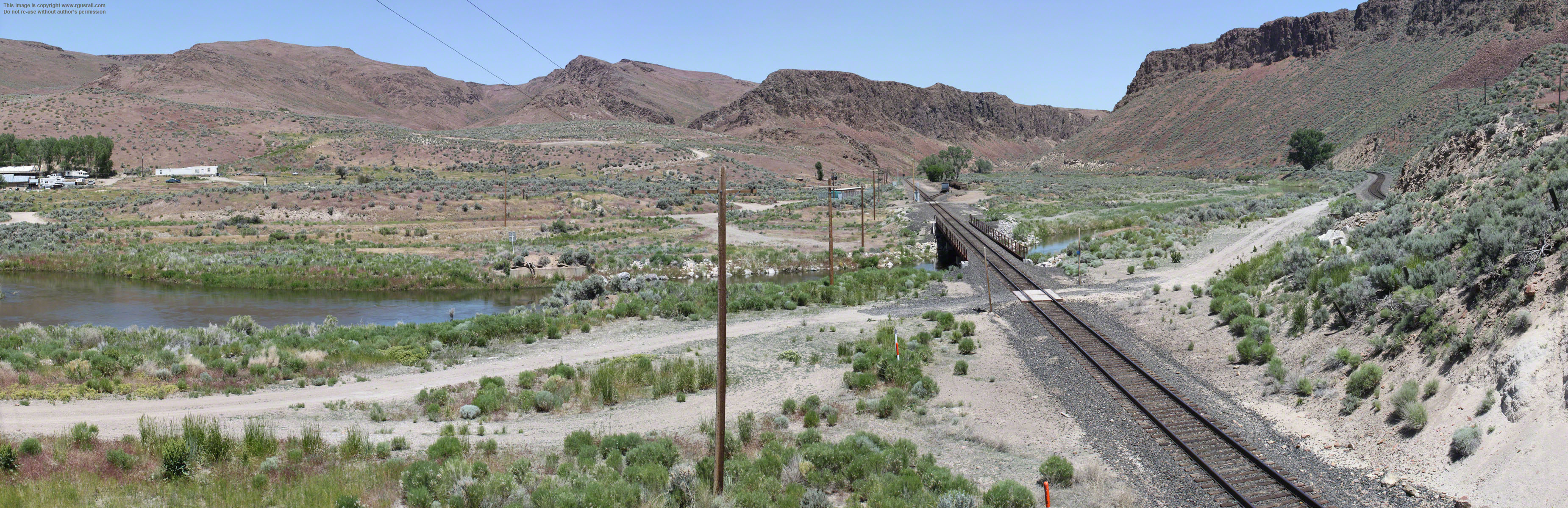
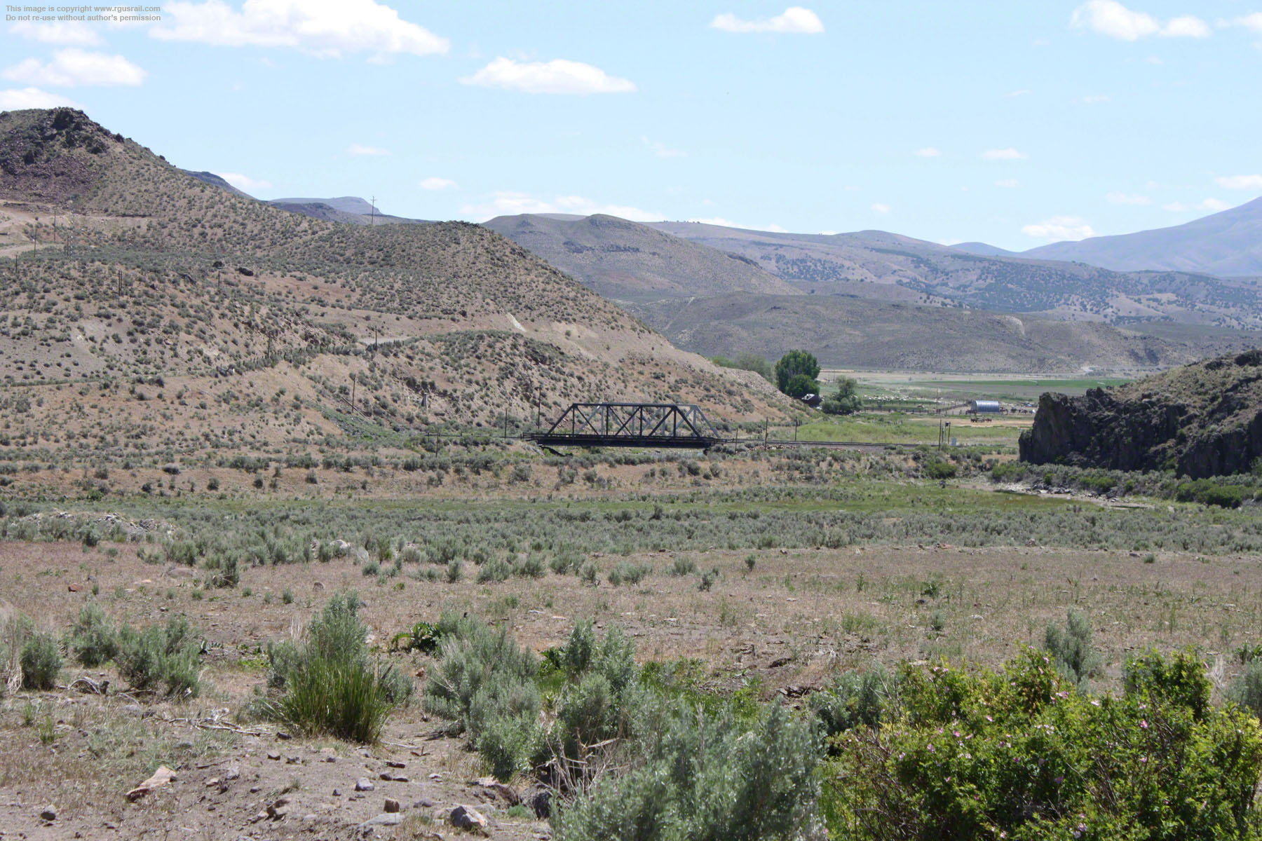
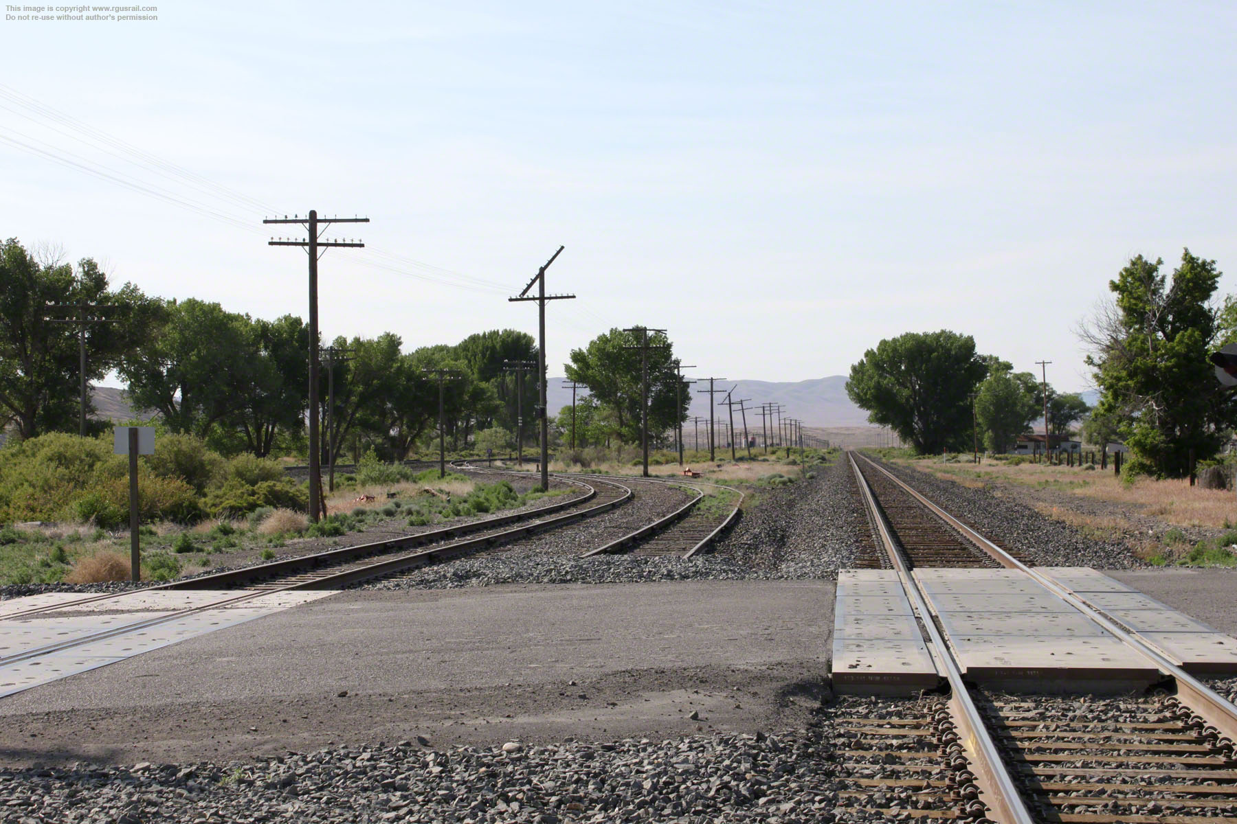
Above, looking northeast from Highway 278 about five miles south west of Carlin, NV. The old Western Pacific line is on the right, the old Central Pacific line is on the left. Carlin is in the distance.
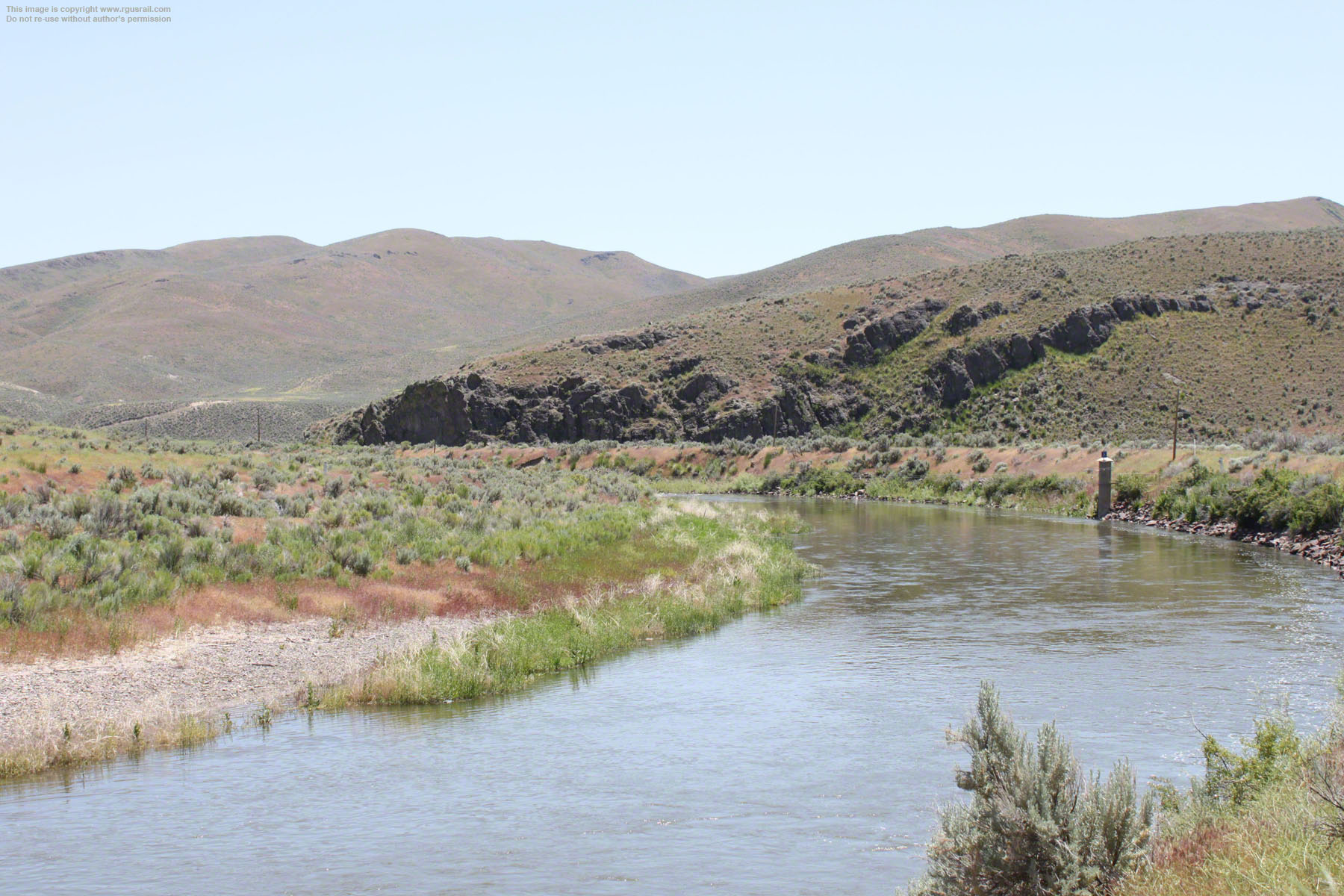
The Humboldt River bisects the two lines, which follow the river basin for the next one hundred and seventy miles to Lovelock, NV.


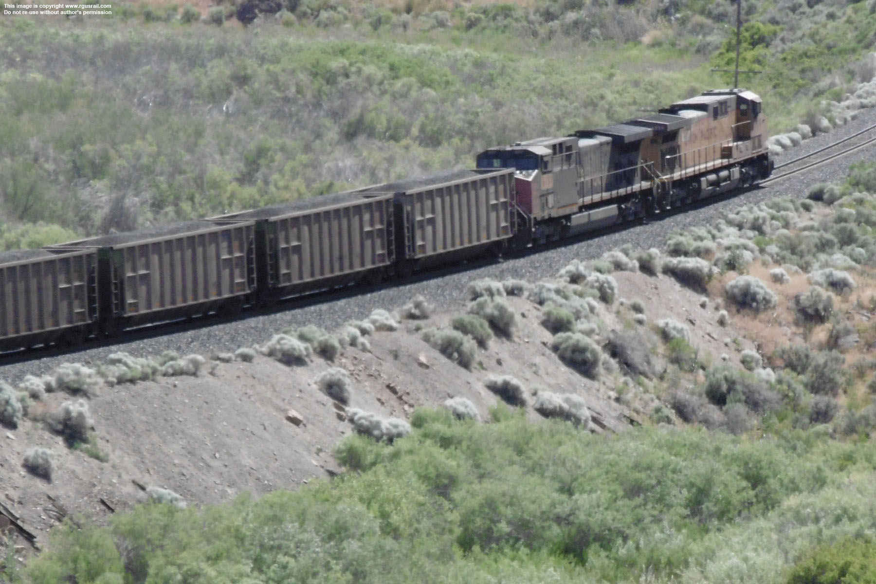
Above and left, UP GE AC44CWCTE #5969 and GE AC44CW #6461 head west with a string of coal hoppers on the old Central Pacific line. This photo was also taken from Highway 278.
The Central Pacific first drove a railroad line through here in 1868 as the company pushed east to join the Union Pacific at Promontory, UT.
You can see photo of the historic Central Pacific grade from Lucin to Rozel, UT, on this website, as well as the Golden Spike NHS, where the two railroads joined.
Below, #5969 and #6461 turn into the canyon. The first escarpment rises on the right.
The Western Pacific completed its line in 1907 as part of the Salt Lake City, UT-Shafter, NV section. In 1885, the Southern Pacific took over the Central Pacific then, in 1901, The Union Pacific took
control of the Southern Pacific, although the old company continued to operate as a separate entity, and final merger did not occur until 1996. In 1983, the Union Pacific acquired the Western Pacific, which is why both lines now carry Union Pacific trains.


Above, “Entering Humboldt Canyon” from Williams’ 1879 Pacific Tourist, p.184. It’s not entirely clear where this is, but Williams’ “tour” is from east to west, so it is most likely somewhere near the eastern entrance.
Below, “Entering the Palisades of the Humboldt”, from Crofutt's 1879 New Overland Tour, p.137. The position of the track in relation to the river suggests this is almost certainly a view just inside the eastern entrance.

Above, looking down on the canyon entrance from Highway 278.

Browse both these titles on the books and manuals page of this website.


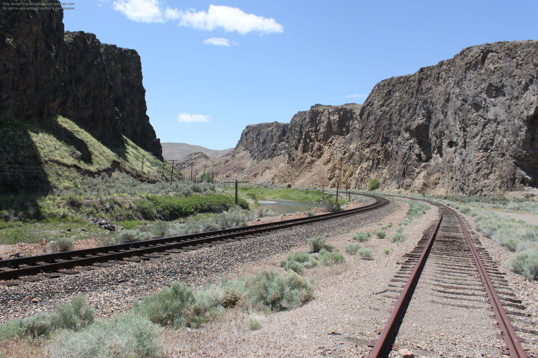
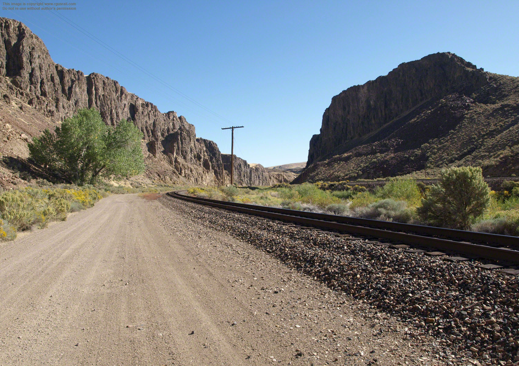
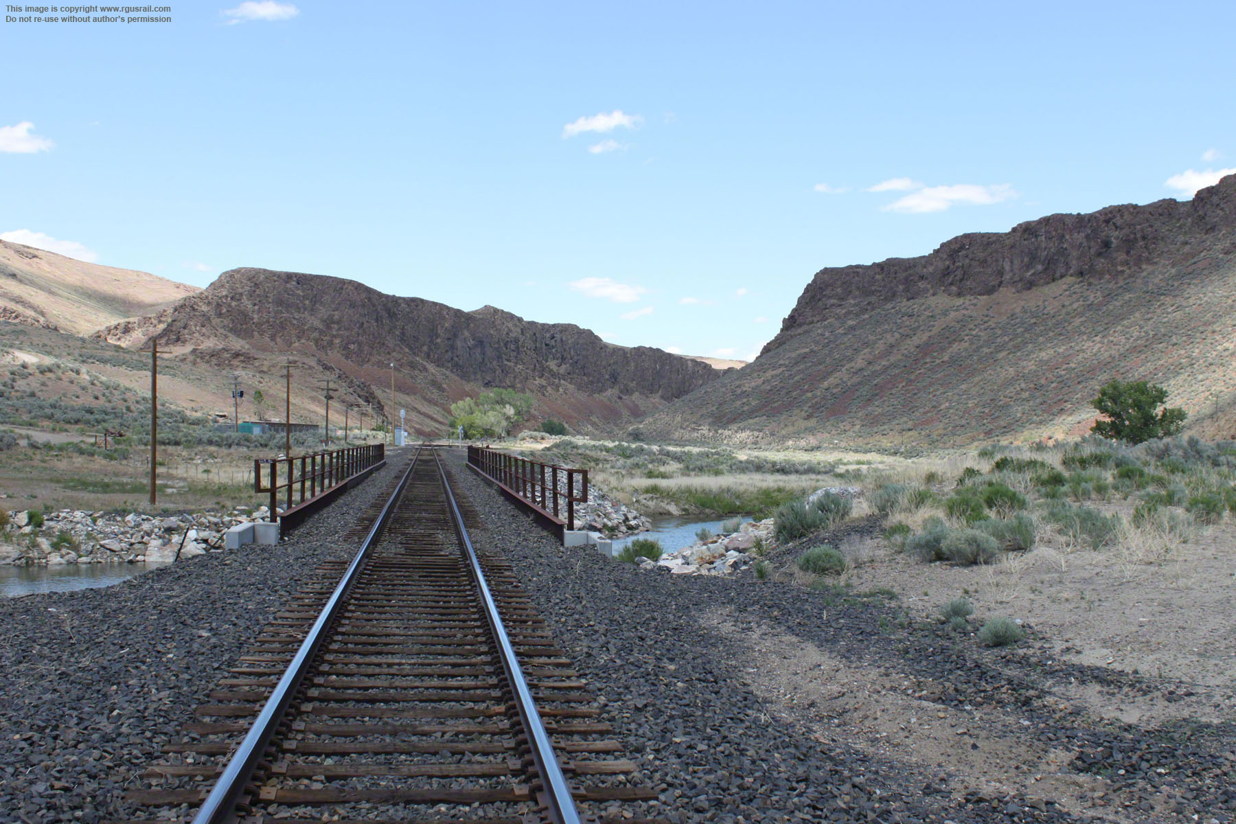
Above, looking northeast along the old Central Pacific line. The canyon head shown in the previous two photos on this page is about a mile northeast of here. You can’t drive from the canyon head, but there is a dirt road off Palisade Ranch Road that criss crosses what were once the Central Pacific tracks up the west side of the river to this point.
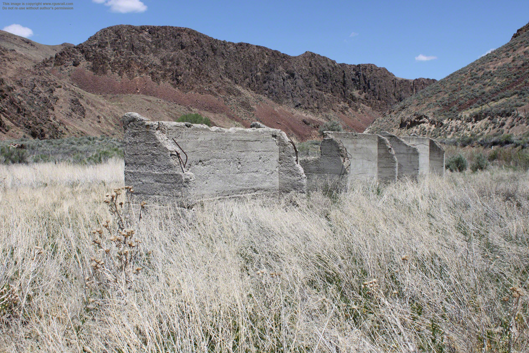
As far as I can establish, the ruins on the hill and the rusting spur line to the left are all that remain of an old rock quarry that operated here probably in the late 19th or early 20th Century.


Above, the old spur line runs from the main line alongside the quarry.
Top photo, all that remains of the quarry buildings are shells bedaubed with graffiti. Lower photo, the remains of loading bays overlook the old Central Pacific line. Click here to see a full 360° panorama from this viewpoint.
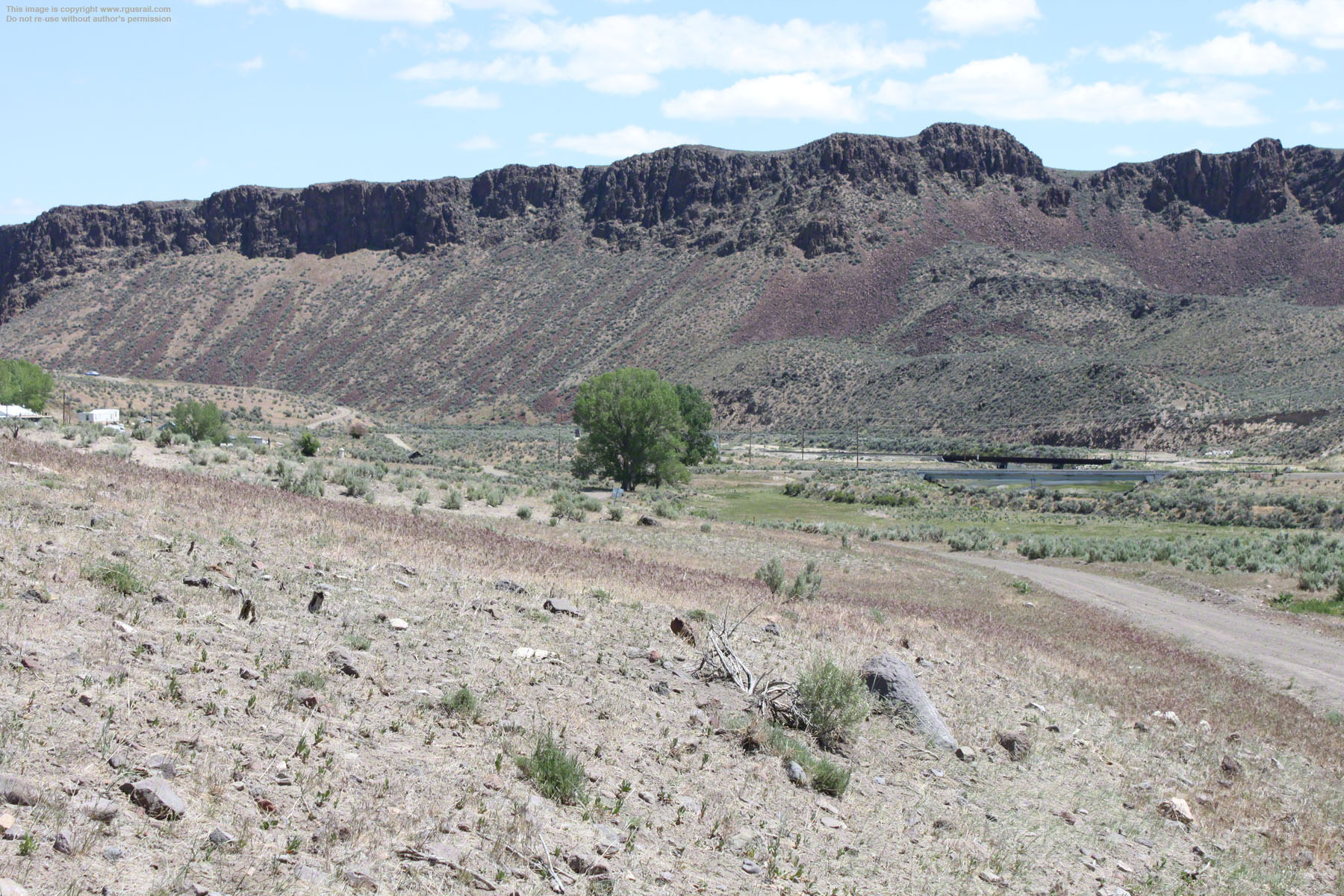
The geologic formation in this area results from a succession of slow moving lava flows, chiefly basalt and andesite, through which the Humboldt has cut a narrow channel between what is now the south end of the Tuscarora Mountains and the north end of the Shoshone Range. The red-brown rocks quarried here are rhyolite, a light weight volcanic rock used in building since the late 1800s, usually as a surface veneer.

Above, looking southwest from the same location as the first photo in this section with UP GE AC45CCTE #7791, EMD SD70M #4903 and EMD 
SD70Ace #8658 hauling a mixed freight east on the old Western Pacific line. Click this link to see a full 360° swf panorama of the view.
Below, a postcard from the early 1900s, "The Elephant's Head, near Palisade, Nevada, Humboldt River". On the reverse, it reads: "This is one of those scenes along the Western Pacific that are always fascinating from the Pullman window."

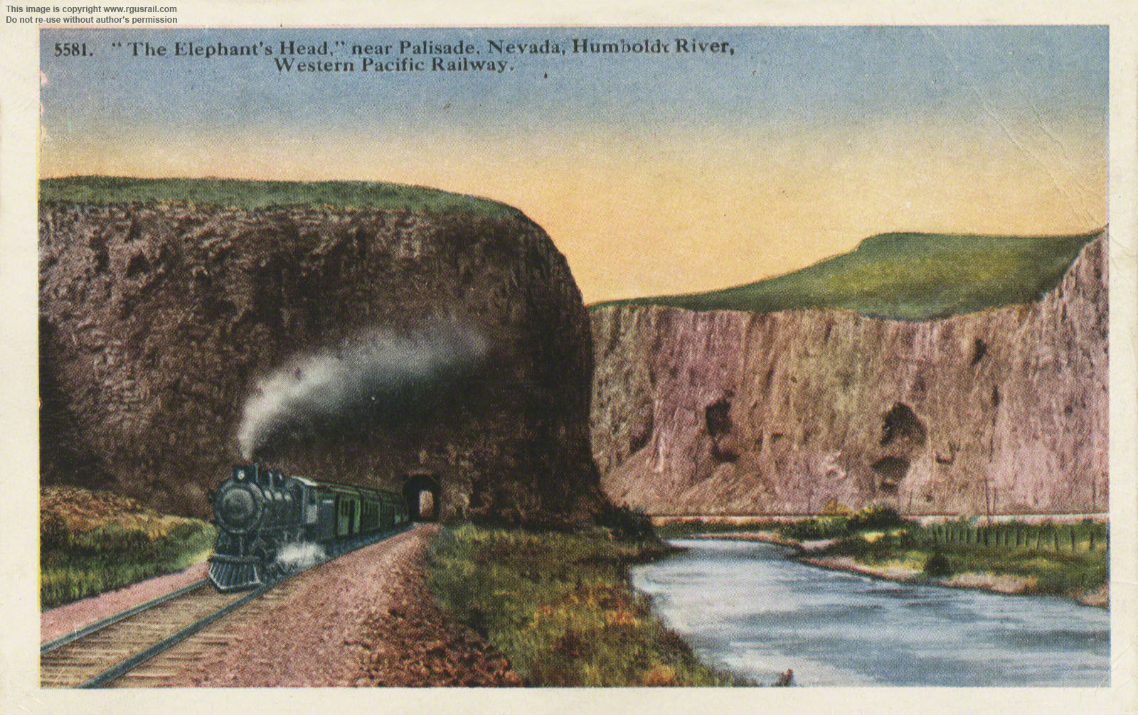
"'The Elephant's Head' is one that will long be remembered by the traveler", it concludes.
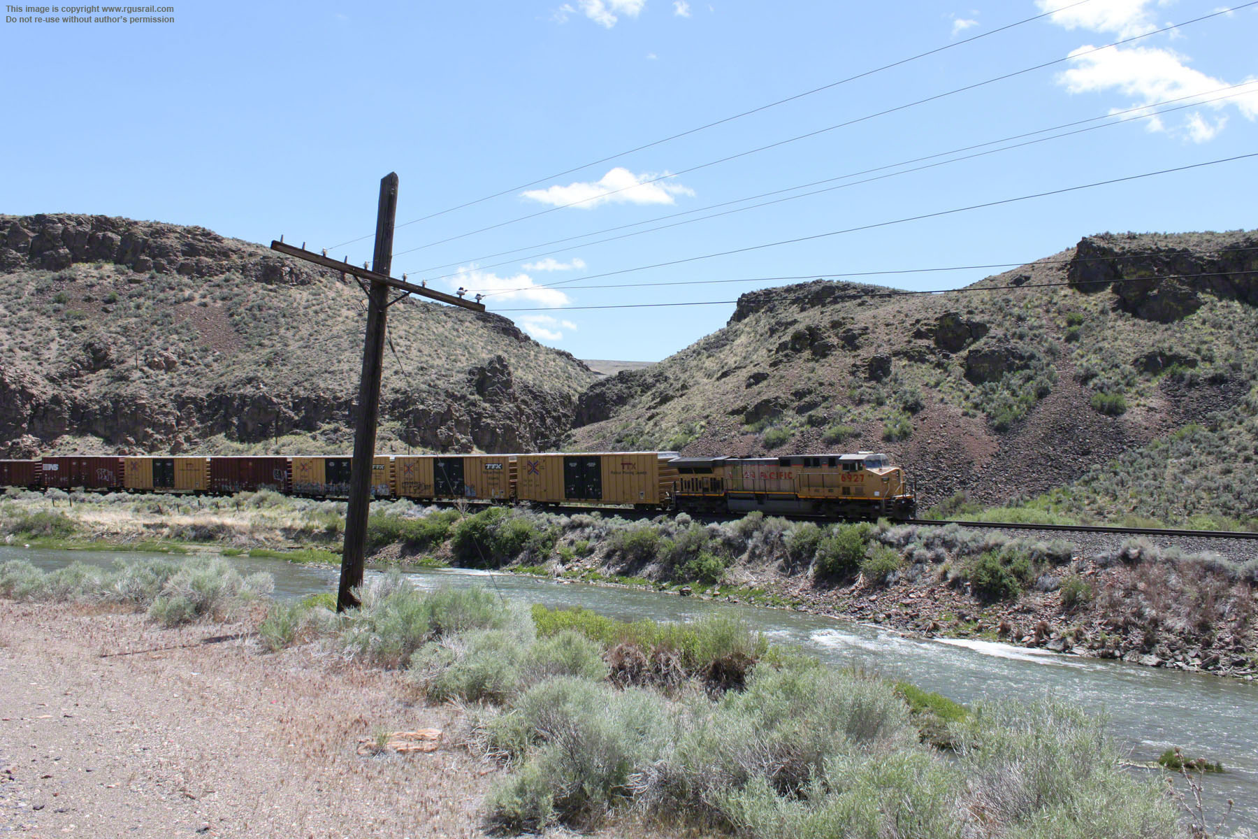
Above, UP GE AC4460CW #6927 follows as helper for #7791, #4903 and #8658.

Above, "Palisades of the Humboldt River, C.P.R.R.", from Crofutt's 1879 New Overland Tour, p.91 (you can browse this book from the books and manuals page of this website). This engraving, probably taken from a photograph, shows what appears to be an inspection train. “The Elephant’s Head” is on the left across the Humboldt River. Comparing the extent of rock on the right in this view with other photographs on this page suggests how much rhyolite has been quarried out of this site during later years.
Croffut described, somewhat hyperbolically: “In passing down this canyon, we seem to pass between two walls which threaten to close together ere we shall gain the outlet. ... The walls in places have crumbled, and large masses of crushed rocks slope down to the river brink. Seams of iron ore and copper bearing rock break the monotony of the color, showing the existence of large deposits of these minerals among these brown old mountains”.
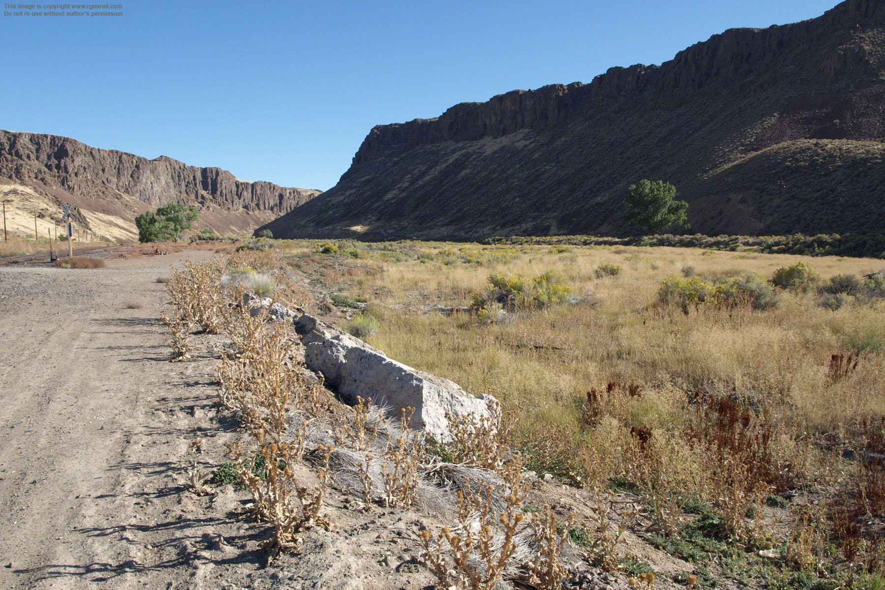
Above, looking south along the old quarry spur.
Below, “Palisade Bluffs, Humboldt River” from Nelson’s 1871 The Central Pacific Railroad: A Trip Across the North American Continent from Ogden to San Francisco. Nelson described the scene: “Bleak, bare, and broken cliffs tower on either side, while, somewhat beneath the traveller, the river rolls in a continuous frenzy, dashing its heavy spray on either side, and filling the air with the wild murmurs of a thousand discordant echoes”, although this description of the Humboldt River is somewhat at odds with its placid depiction in the engraving.
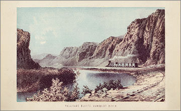
You can browse this book from the books and manuals page of this website.

The somewhat exaggerated scale of “The Palisades on the Humboldt by Thomas Moran” above seems to owe more to the engravers, Philip Meeder and F. Y. Chubb, than to Thomas Moran. In fact, I have not been able to identify a Thomas Moran to match this view, although he sketched throughout the Old West, and there are references to his drawing in the Palisades.
The engraving is from Williams' 1879 Pacific Tourist, p.183 (you can browse this book from the books and manuals page of this website). Despite the extreme scale of the cliffs, apparently delineated by one of America's then most celebrated monumental landscape artists, Williams is rather lukewarm. Approaching Palisade at this point, “the ledges on the right side of the track seem to stand up on edge, and [are] broken into very irregular, serrated lines--the teeth of the ledge being uneven as to length”. Then after describing the town as “a growing little place”, he adds: “[it] is located about half the distance down the canon (sic), and the rocky, perpendicular walls give it a picturesque appearance. The lower half of the canon is not as wild and rugged, however, as the upper half”.


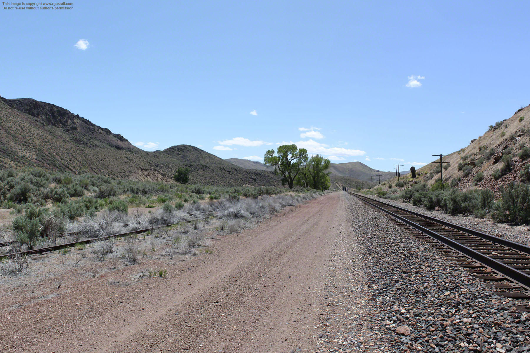
Looking northeast a half mile from the old quarry spur. The old Central Pacific grade is in the foreground and the western portal of the tunnel through “The Elephant’s Head” is in the centre of the view.
As the Central Pacific had laid its track on the wider, northwestern floor of the canyon, the Western Pacific was forced to lay on the narrower, more difficult terrain of the southwestern side. This meant tunnelling through the roughly sixty foot high outcrop at this location.


Above, the western portal of the tunnel through "The Elephant's Head".
Above, looking south towards Palisade from roughly the same location.

It is not clear where the view of “Palisade Cañon” above has been staged (Picturesque America, vol.2, 1872, p.189), although the wide foreground river bank suggests it is probably from a cleft in the west wall.
The accompanying text describes the “refreshing grandeur of scenery of the Palisades--though the finest is not seen without leaving the established route ... It is here that you come upon such glimpses and vistas as the ones Mr. Moran has drawn--breaks in the rocky wall, through which one looks out on really perfect mountain-pictures” (p.193). Again, I have not been able to identify a Thomas Moran to match this view.


Above, “San Francisco Overland Limited, Palisade Canyon, Nevada”, from Southern Pacific's early 20th Century The Overland Trail (you can browse this book from the books and manuals page of this website).
This is not an overly exaggerated visual representation. The text reads: “[t]he walls rise on each side in rugged grandeur attaining in places a height of a thousand feet. The peculiar stratification of the rocks resembling that of the Hudson has lead to the term, Palisades of the Humboldt”.
Above, two views progressively further south along the grade. The lower photo is looking north from the outskirts of what was once the main rail yard in Palisade. They show the sheer canyon walls that earned it the name “Palisade”. Like other formations given the name, it referred to the rampart or wall like appearance of the escarpments.
This part of the canyon is not particularly extensive, only about two miles long and running roughly northeast to southwest, although there are outcrops at other places east and west further along the line. These may explain the alternative names of “Twelve Mile Canyon” and “Ten Mile Canyon”.

Above, looking east along the Humboldt River from edge of Palisade.


Above, the Division of Historic Preservation and Archeology, Northeastern Nevada Historical Society has erected a marker at the intersection of Highway 278 and Palisade Ranch Rd about a mile and a half from Palisade.
Originally called Palisades, the town was laid out in 1870, when
the Central Pacific arrived. In the early 1870s, it rivaled nearby Elko and Carlin as a departure point for wagon, freight and stage coaches heading south
to the mines in Mineral Hill, Eureka and Hamilton. For much of the way, they followed Pine Valley, which was to become the route of the Eureka & Palisade Railroad in 1875.


Above, looking south down the old Central Pacific grade towards what was, from the late 1870s, a rail yard shared with the Eureka & Palisade. The original CP line curved off to the left of the clump of trees in this photograph but, after taking over the CP in 1901, the Southern Pacific later rebuilt the line along its current orientation. The Eureka & Palisade Railroad yard was a little further to the left of the old CP grade.
Below, the remains of a bridge at the eastern end of the yard constructed by the E&P across the Humboldt some time after 1916.

The bridge connected to the Western Pacific’s Freight Station, which was on the left bank.
Top view, looking north. Lower view, looking south from the same location. An incline and bunker built in 1906 to transfer ore from E&P’s narrow gauge cars to  Central Pacific standard gauge cars stood roughly at this spot. An E&P stock corral was to the left. Click this link to see a 360° swf panorama from this viewpoint.
Palisade was the headquarters of the Eureka & Palisade, which ran eight-five miles south to Eureka, NV. It was built to carry silver-lead bullion smelted in Eureka from ore produced in the local mines up to the Central Pacific at Palisade. Freight was shipped back to Eureka, particularly lumber to provide trusses for the mines.
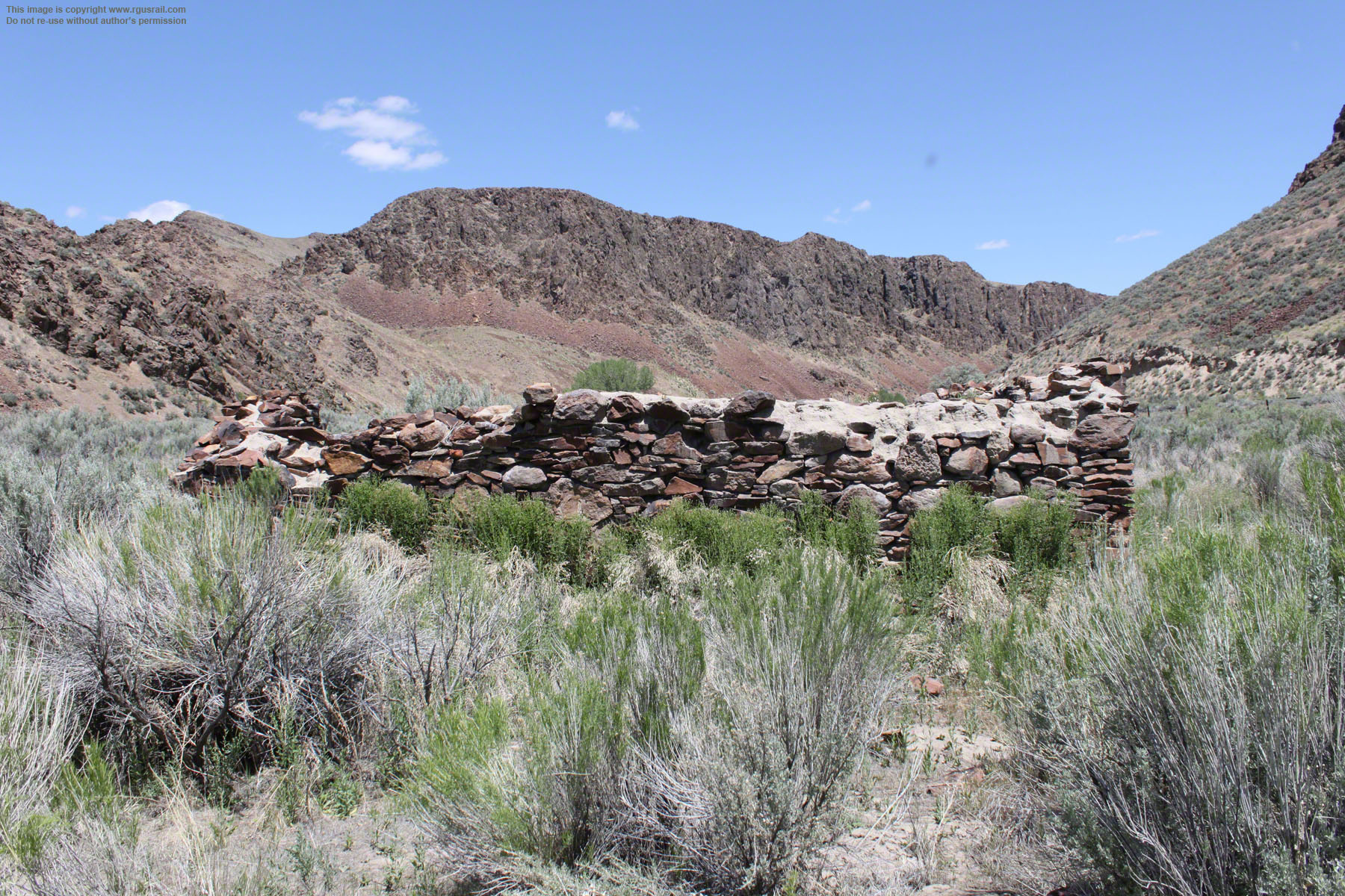

Above, ruins of what is probably the old E&P store room adjacent to the turntable.


Above, the remains of what was probably the old E&P car shop.


Above, two views of the remains of the small bridge that once crossed the river to the Western Pacific passenger station on the eastern side.
The Western Pacific was a relative latecomer to the transcontinental route. It was formed in 1903
in an attempt to challenge the Southern Pacific's hold over rail services into northern California, and its passenger services between Salt Lake City/Ogden, UT, and Oakland, CA, which could be flagged at the station in Palisade, were in direct competition with SP's, which could also be flagged at Palisade. Completed in 1909, it was the last railroad completed into California. Its route was famed for passing through the scenic Feather River canyon.

Above, a view looking south standing roughly where the original Central Pacific line curved to the west. The Eureka & Palisade line was a little to the left of this. After the Southern Pacific realigned the track, it built a Freight House roughly to the right. The original E&P passenger depot was relocated to a position behind the SP Freight House out of view on the right. The depot had also served the CP from 1875 and continued to serve the SP after being relocated.
The E&P rostered four locomotives, fifty-eight freight cars and three bright yellow passenger coaches. Most of the freight and flat cars were built in the car shop, the remains of which are shown earlier on this page. There was also a turntable, four stall engine house, boiler room, blacksmith shop, machine shop and ice house at the site, as well as the store room shown earlier on this page.
During the 1870s and early 1880s, the railroad boomed. According to Croffut’s 1879 New
Overland Tour, in 1877, it transported over thirty-one million pounds of ore. The following year, shipments of bullion were valued at seven million dollars and, in 1880, the reported return on investment in the railroad was 15%, and a massive 53% on its sister service, the Ruby Hill Railroad, also owned by the E&P.

Above, looking north across the old rail yard. The concrete blocks in the foreground may well once have been part of a structure on the site. Below, looking northeast across the site of the rail yard. The mound beside the track on the far right is the location of the SP freight house. The passenger depot was just to the left of this.
The ore bonanza ended in 1885 and service on the E&P shrank accordingly. The daily passenger service was cut to a thrice-weekly one in 1888, and the Ruby Hill closed in 1893, the same year the E&P posted its first annual operating deficit.
Above, a double-stack east bound intermodal freight is hauled by UP #5470 (GE C45AC-CTE) and #4405 (EMD SD70M) along the old Western Pacific line. The view is from the road leading up to the old cemetery.
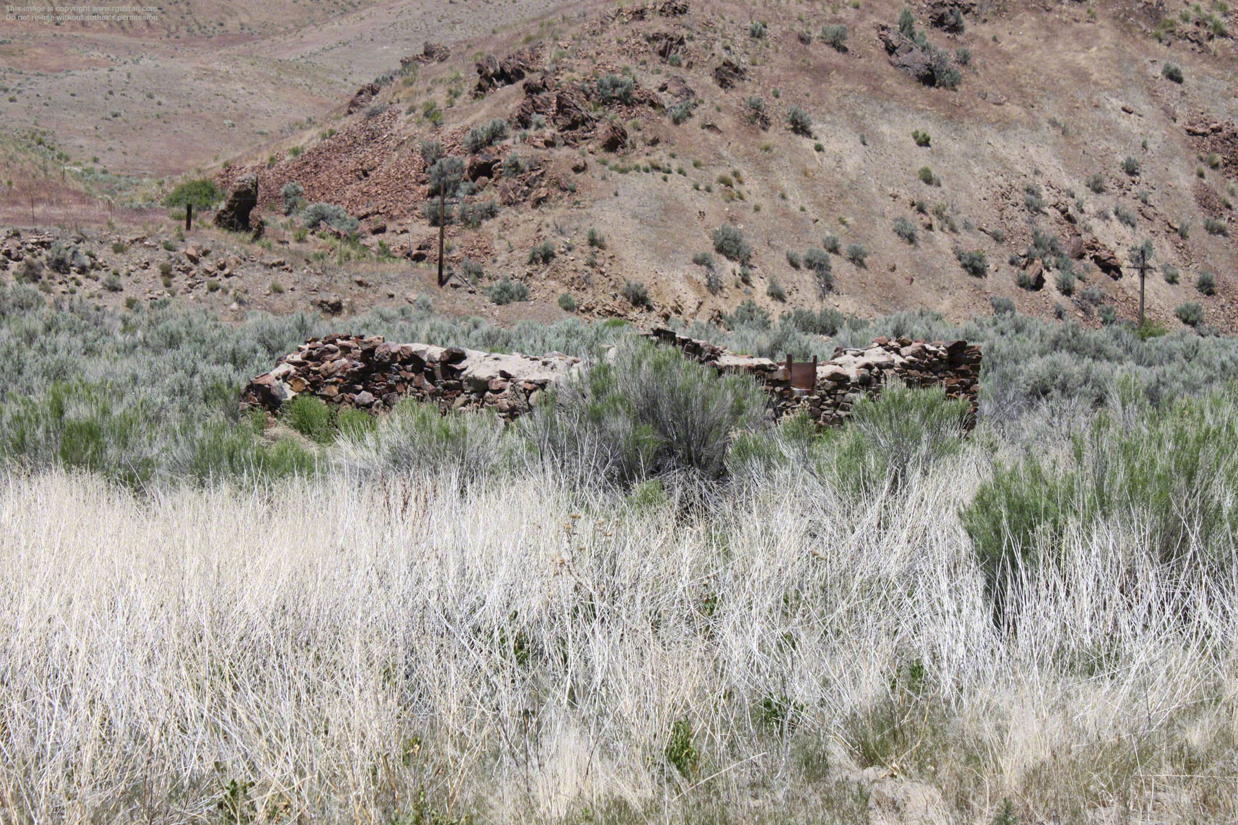
Left, a view looking southeast from what was once the site of John Swan's Hotel. The road running through the middle of the photograph is the old route of the E&P. It is now a UP service road.

The ruins of the car shop and store room are in the middle distance of the view above.
The dirt road that cuts from the lower left of the view on the right once crossed the Humboldt close to the SP tunnel entrance. It was the main road into the township.
The Eureka & Palisade went into receivership in 1900. Sold in bankruptcy, it was bought for $300,000 (it had cost more than $1,500,000 to build) and reconstituted as the Eureka & Palisade Railway in 1902. Three years later, Eureka again began to boom and ore shipments on the E&P restarted in 1906. By 1909, it was shipping 200 tons daily.

The E&P general office stood to the left of the pile of rails in the view above.
Right and below, looking north across the Humboldt to the area once occupied by the joint CP/E&P rail yard.
Business again stalled on the E&P following a disastrous flood in March 1910. Eleven miles of track were destroyed along Pine Creek and operations ground to a halt. The roundhouse and shop buildings at Palisade were covered to a
depth of five feet, and a gigantic lake was formed running thirty miles south along the Pine Valley. Both the SP and WP had to halt services temporarily.

Left, looking north to the area once occupied by the Western Pacific depot.
For the E&P, however, the impact of the 1910 flood was particularly harsh. After carrying out an appraisal of the likely costs to rectify the damage, the estimated $150,000 led the company to suspend operations The line did not reopen until 1912 under new ownership as the Eureka-Nevada Railway Company operated by the Nevada Transportation Company under the ownership and management of John E. Sexton.
The cost of rebuilding the line, led to an almost doubling of freight charges from $1.35 to $2.60 a ton, too expensive for the Eureka mines to bear with the low grade of ore left. As a result, the mines stayed shut for all but a short period between 1921 and 1923.

Most employment in the township was provided by the E&P, which also supported ancillary businesses, such as shops and a small hotel. There was also a school, as well as Odd Fellows and Masonic lodges.
The settlement may have had as many as six hundred inhabitants when the Eureka mines were at the height of operation in the early 1880s, but this had settled down to about two hundred and fifty by the turn of the 20th Century. After 1910, however, with mining declining, the E&P’s closure and reduced services, Palisade also declined.
From 1927, declining business and falling revenues led to further operating losses for the railroad almost every year. Finally, on 21st September 1938, the line was abandoned.
The "Eureka" is one of only two surviving E&P steam locomotives. It is listed on the United
States National Register of Historic Places but is privately owned. The other locomotive to survive is #7, a 2-6-2 Prairie type built in 1915 by the H. K. Porter Company. It is privately owned but can be seen at Silverwood Theme Park in Athol, ID, running daily during theme park operation.

The old road south from Palisade originally ran across the middle foreground in the view above.
In 1915, the town still had an official population of two hundred and forty-two but, within a few years, it had dropped to less than one hundred and fifty. When the Eureka-Nevada Railway pulled up its rails in 1938 (they were, ironically, sold to Japan), the end of Palisade was inevitable, although it clung to life for a few more years. The post office finally closed in 1961 and Palisade soon after became a ghost town.
Today, all that remains are a couple of old wooden cabins, a few ruins of the original buildings, the scattered detritus of the former residents and a couple of commemorative plaques, although there are a few, more modern, farmhouses and outbuildings in the area.

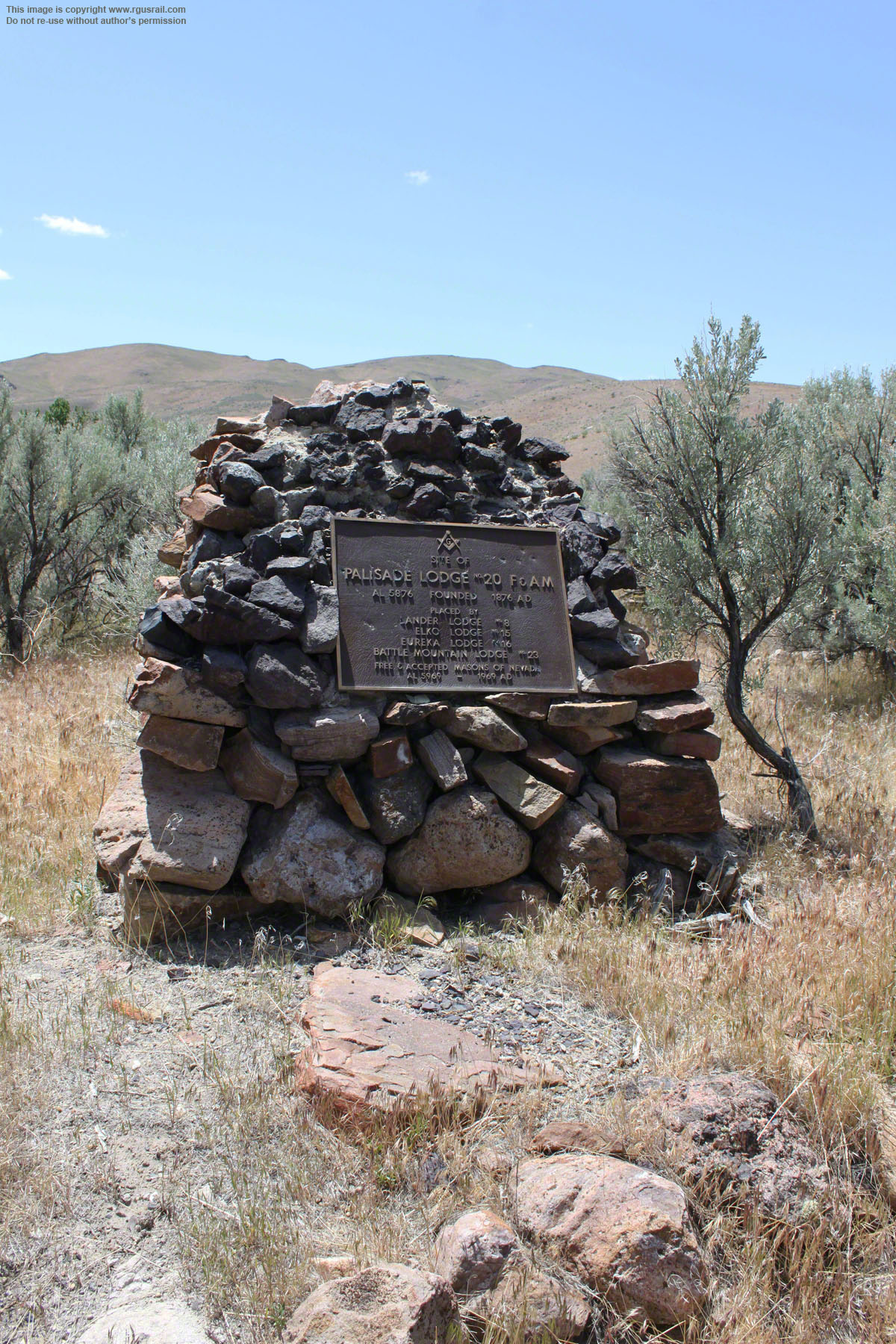
Right, the plaque commemorating old Masonic Lodge No.20.
The lodge first met on 28th July 1877. At its height it had twenty-five members, but struggled to recruit new members and hold meetings. The Grand Lodge finally declared its charter forfeit in 1886.
Above, a view of Palisade from the bluff through which the realigned SP ran (now the UP westbound grade) from about 1900. As far as I can establish, the buildings are as follows: 1. Schoolhouse,
2. Cemetery, 3. J. E. Sexton’s house, 4. John Swan’s Hotel, 5. Courthouse, 6. E&P General Office,
7. E&P/SP Depot, 8. E&P Freight House, 9. E&P Engine House, 10. E&P Car Shop. The general office, depot and freight house were all moved with the SP main line realignment.
Below, another view of Palisade. The additional buildings along the river suggest this is a later date.


However, absence of the ore transfer incline dates this postcard to some time before 1906.
Top, an E Clampus Vitus plaque dedicated on 1st June 1992 commemorating the E&P.
The Ancient and Honorable Order of E Clampus Vitus, to give it its full name, is a fraternal organisation rooted in the California Gold Rush. Founded to spoof other fraternal orders like the Masons, Elks and Lions, the Dog Latin name has no known meaning and its origins are unclear. Today, the organisation specialises in placing commemorative plaques on sites often overlooked by more serious historical organisations, particularly with a Western heritage or mining interest (you can see another E Clampus Vitus plaque on the Tehachapi Loop page of this website).


One of the fascinating things about Palisade is the ghostly presence of
a once bustling community.
Each time I visit, nature has invaded and eaten away a little more of what was once there. So, for me, the traces are a living presence in the historic landscape.
Above, the ruins of the original one room schoolhouse.
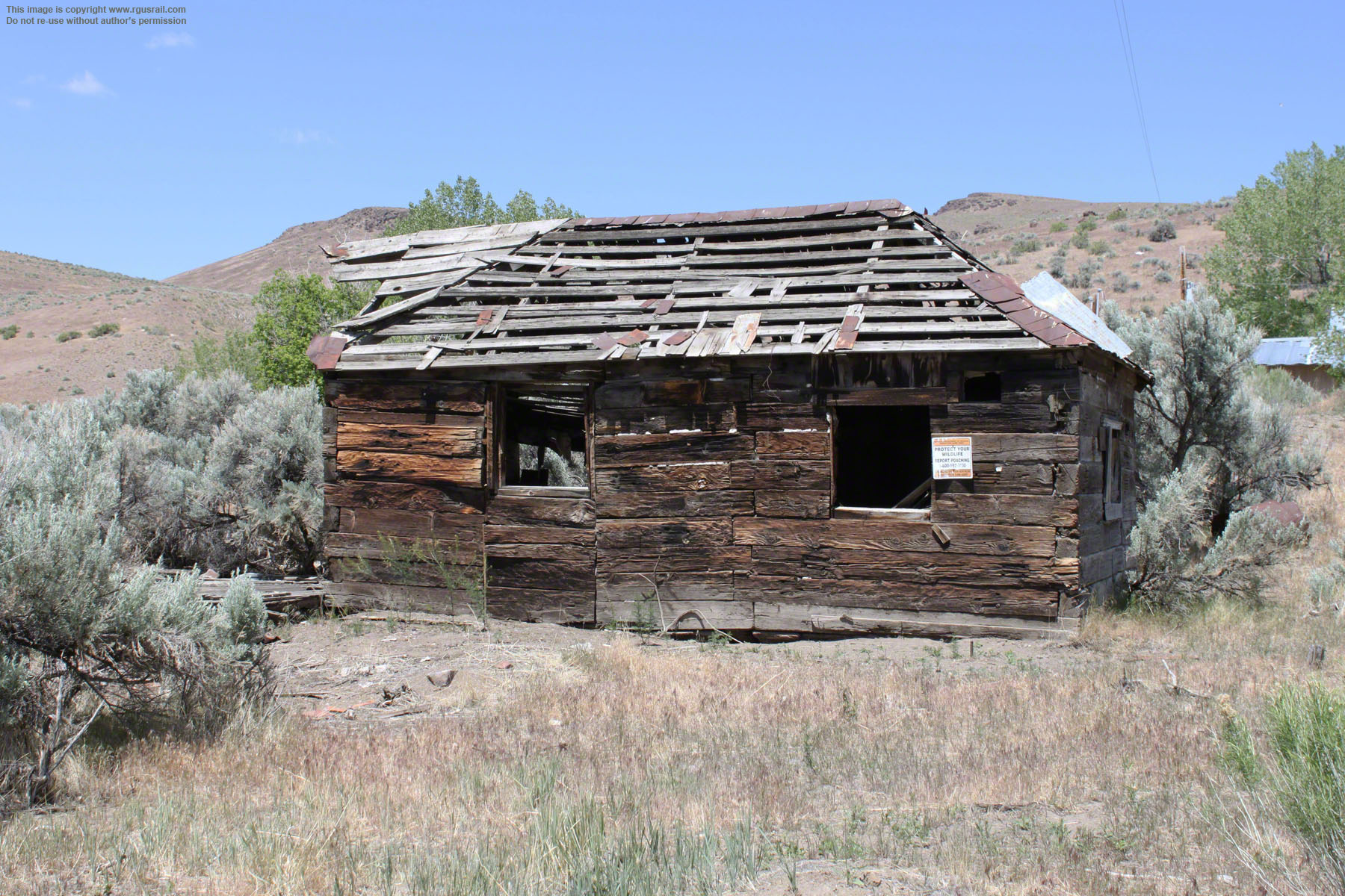


Above, an old building constructed of railroad sleepers near the schoolhouse.


Above, foundations, wall/fence posts and abandoned cars just to the west of the railroad.


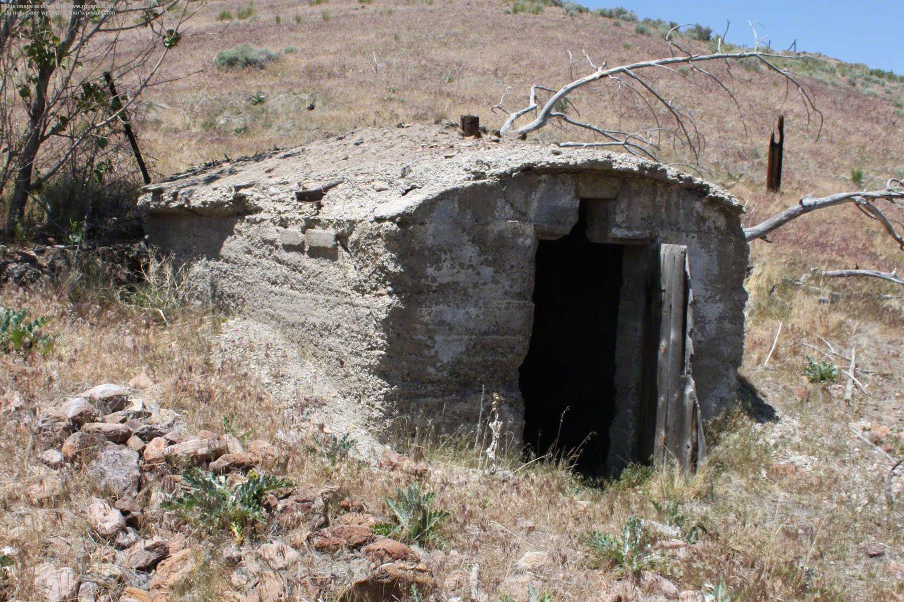
Entrances to what must have been storage areas dug into the side of the canyon.


These concrete steps are all that is left of the courthouse.

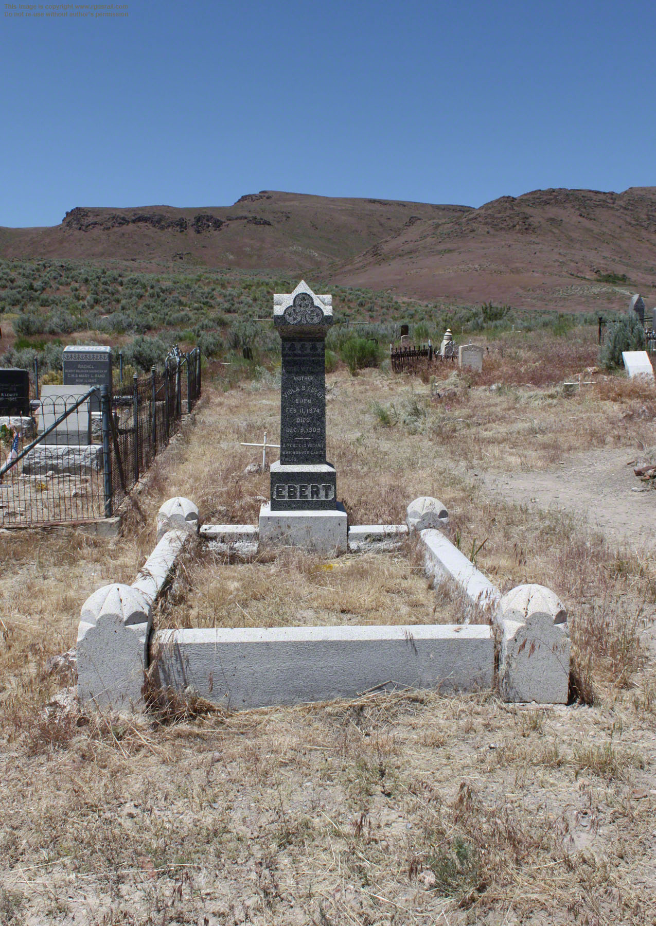
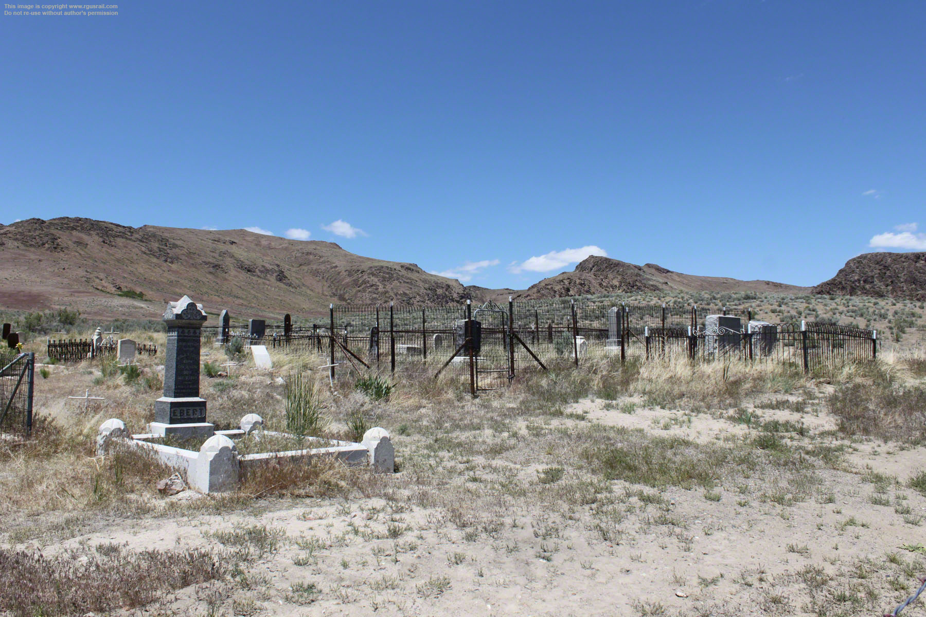
The cemetery has survived overlooking the ruins. It is still occasionally visited and many of the graves are in good condition.
After the Eureka-Nevada ceased operating, 160
acres of the Palisade township remained in the ownership of the Sexton family for the next sixty-seven years.


On Tuesday 26th April
2005, the 160 acres went under the hammer at the Greg Martin Auction House in San Francisco, CA, as part of an antique guns and Western memorabilia auction.
Heir to the property, Atlanta businessman John Sexton, needed the money for his daughter’s college tuition.

Most of the graves in the cemetery date from the early 20th Century.
The property was sold to an anonymous bidder for $150,000.

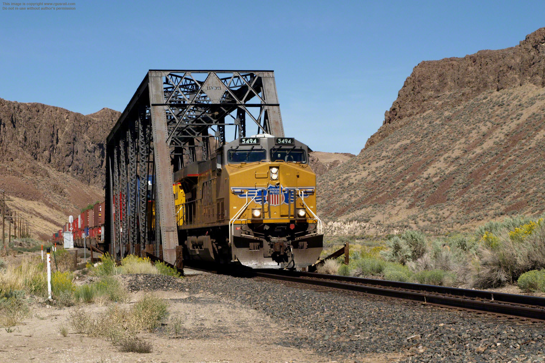
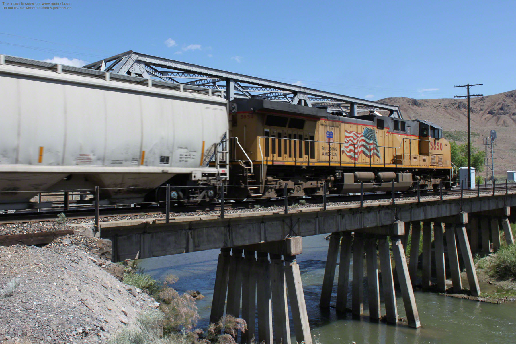
Above, UP GE 9-44CW #5494 hauls a double-stack intermodal freight west. Traffic is intermittent along both lines, and you may wait some time before anything comes along. Amtrak's California Zephyr passes through daily at 3.00am east bound and 9.30pm west bound.
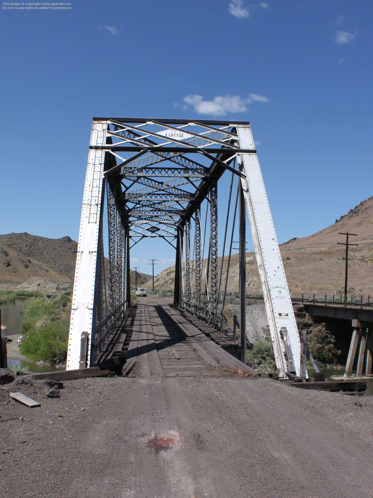
When I visited in 2008, this trestle bridge carried the old Southern Pacific line over the Humboldt River. But, as you can see from other photos on this page, a year later, it was gone. The bridge has "1903" in the steel diamond above the track. This is three years before the SP realigned the track, so it can't be a survivor of the 1910 floods. It’s a standard truss span used all along the old SP, so 1903 is probably just the production date.


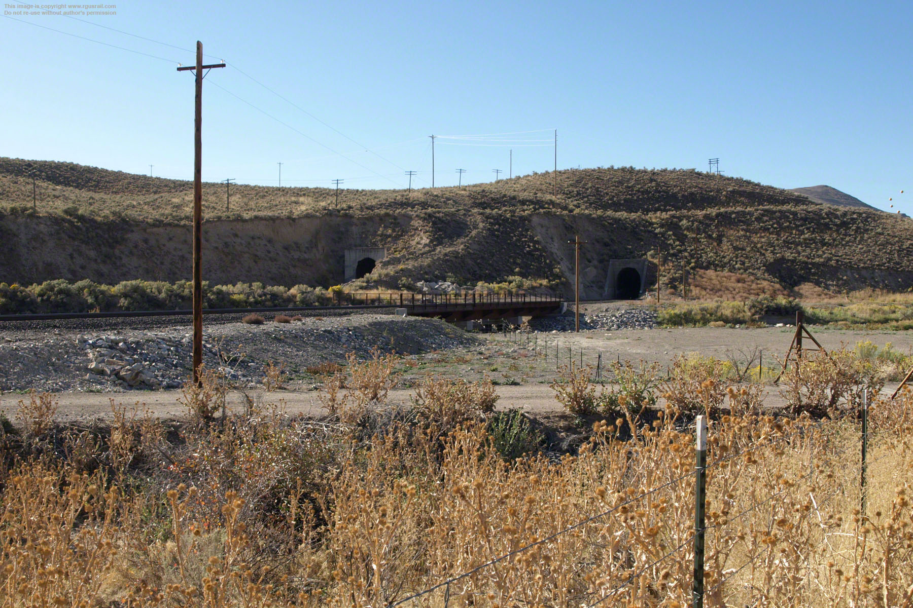
Above, the double-stack passing through the old Southern Pacific tunnel.
The tunnel was built in 1907 with the realignment. It is 879' long, No.1 on the old Southern Pacific Salt Lake Division stretching over five hundred and fifty miles from Sparks, NV, to Ogden, UT.

The dressed concrete portal is more recent.

In the top view, the old Western Pacific tunnel is on the left, the Southern Pacific on the right.
The lower view is looking north from the portal of the old Southern Pacific tunnel. This is where the 1903 trestle originally stood.
The Western Pacific tunnel, above, was built in 1909. It is 1,060’ long, No.39 on the WP.


Above, UP EMD SD90MAC-H2 #8534 and UP GE AC44CW #6996 head east with a mixed freight.


Above, looking southeast from where the old schoolhouse stood.
The old Western Pacific is the upper line with the top of tunnel No.39 just peeking out above a spur of the bluff. The realigned Southern Pacific grade and tunnel No.1 cross the middle of the view. The old road bridge abutment on the far bank of the Humboldt is in the centre. The original Eureka & Palisade grade ran close to the bank on this side and crossed the river out of view just to the right. The original Central Pacific grade ran along the low embankment in the lower centre.


Above, looking west across the old Eureka & Palisade grade to the Central Pacific grade.
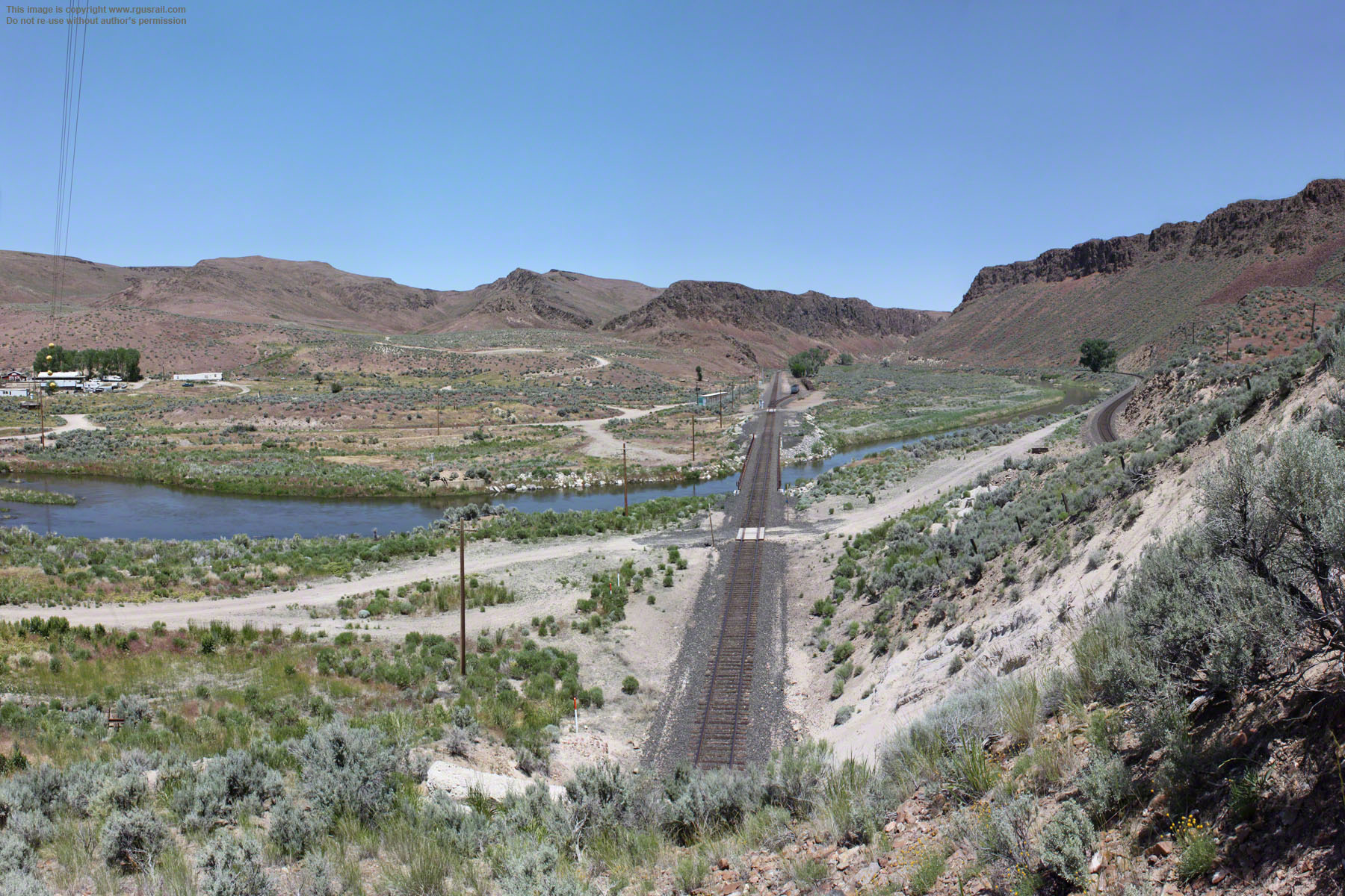
Top photo above, the Eureka & Palisade line crossed the Humboldt River roughly where the modern road bridge now stands but with a more north-south orientation. It then followed the river bank around the bluff to Pine Creek and headed south.
Lower photo above, looking along the old Central Pacific grade from the north end of the bridge. The pre-1907 grade crossed what is now Palisade Ranch Road just this side of the bridge (the shallow creek cutting the grade on the right would have been bridged). It then curved along the river to the left. These photos show how low the grades were in relation to the river level, which made the 1910 flood so devastating.


Above, following the old Central Pacific grade around to the other side of the bluff.


Above, Tunnel No 1 is on the left, Tunnel No. 39 is on the right.
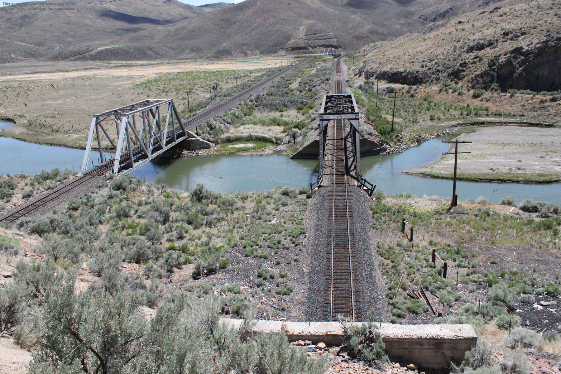


Above, the old Western Pacific and Southern Pacific lines crossing the Humboldt.

The Southern Pacific exits from tunnel No.1 above and on the right of the photographs on the left. The Western Pacific exits from tunnel No.39 on the left.
The Eureka & Pacific grade originally ran along the bank of the river crossing both lines between the tunnels and bridges. The road curving in from the right beneath the hill on the other side of the river is where the old Central Pacific grade rejoined the original alignment.
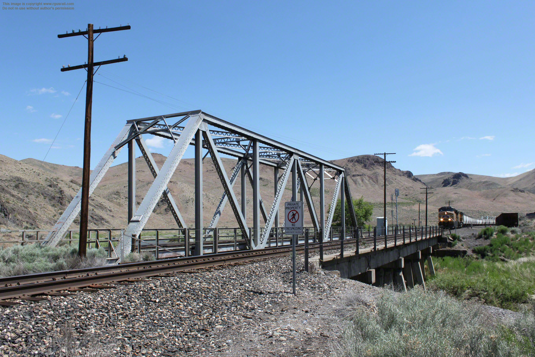
There is no visible date on the old Western Pacific bridge, but the old Southern Pacific bridge is dated 1906. Again, this is before the realignment, so 1906 is probably also just the date of production.


The panorama above encompasses the curve of the Humboldt River and alluvial wash where it is joined by Pine Creek. The cut in the lower foreground is evidence of the E&P grade. From here, it ran south to Eureka and the ore mines that sustained both the old railroad and the local economy.
Both the old Western Pacific and Southern Pacific lines run from the right across the middle of this view.
Above, looking east from further along Frenchie Road, just as the Humboldt is about to disappear from view.
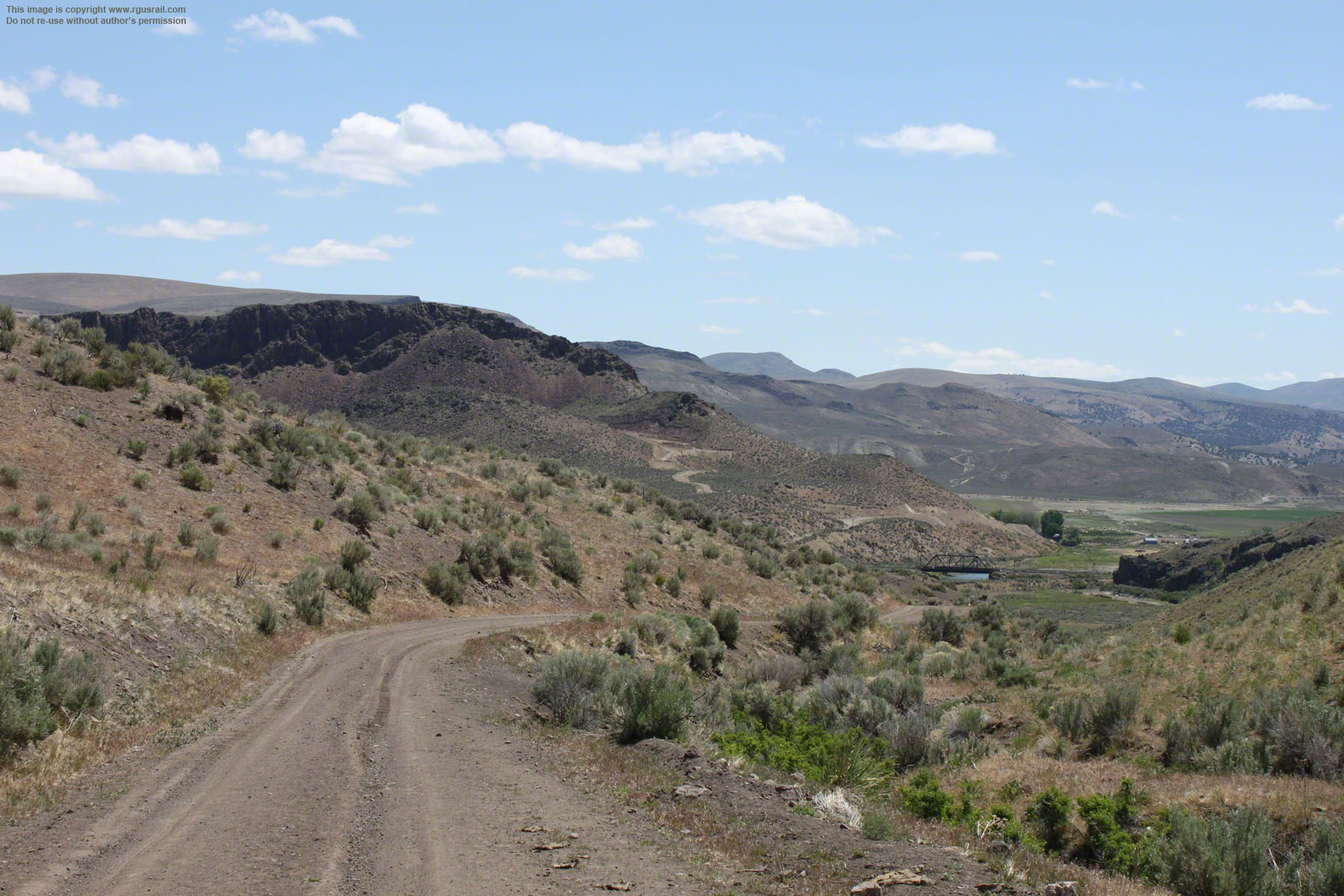
You can drive the six and half miles north up Frenchie Road to the I-40. Although I haven’t done it, I’ve read on other blogs that it probably requires a four wheel drive vehicle and shouldn’t be attempted in bad weather. About three and half miles from Palisade, you turn sharp left off Frenchie Road to follow another unnamed road four miles to Barth. Again, the road is rough: this is four wheel drive country.
Above, the river and both lines enter a canyon defile below what is probably the "Red Cliff" referred to by Crofutt.
The Humboldt rises in a spring called Humboldt Wells just outside the city of Wells, NV, and runs roughly east to west draining tributaries along its course. The first recorded encounter by a European was in 1828. It went by various names until the explorer John C. Frémont named it after the 19th Century German naturalist Alexander von Humboldt in 1848.
Above, looking east towards the two bridges from Frenchie Road on the way to Barth.

Above, the dirt road winds its way through the hills towards Barth.

At 9:15 pm on the 12th August 1939, Train No. 101, The City of San Francisco, left Carlin, NV, heading west running twenty-nine minutes late. The fourteen car consist was headed by three power units, EMC E2 SF-1, SF-2 and SF-3. Eighteen minutes later, at Bridge No. 4 sixteen miles east of Carlin, the train derailed.
All but three cars left the track, catapulted into the Humboldt River. Twenty-four passengers and crew were killed and one hundred and twenty-one injured.
A coroner's jury and an Interstate Commerce Commission enquiry both concluded that the derailment was caused by the deliberate misaligning of a rail, but others suggested it was caused by the train travelling at excessive speed. During investigations over the following months, thousands were questioned. Twenty-six were arrested, but no-one was ever charged.
A reward of $10,000 for information that would provide the reason for the derailment was never claimed, and controversy about the true cause of the wreck murmurs on to this day.


Above, looking across the river valley at the site of the wreck. The original Central Pacific grade ran along the brush covered embankment in the lower part of the view.
To get to the site, you have to walk about a mile off Pioneer Pass Rd, which winds between Beowawe and Barth. There are no markers at the site and no debris. Since the wreck, the river has been rerouted through a canyon cut in the side of the hill north of the west bound tracks, and the bridge and a tunnel on the adjacent east bound tracks have been eliminated.

Above, photos of the wreck from the official report by the Interstate Commerce Commission.
The site of the wreck is roughly in the centre of the view above.

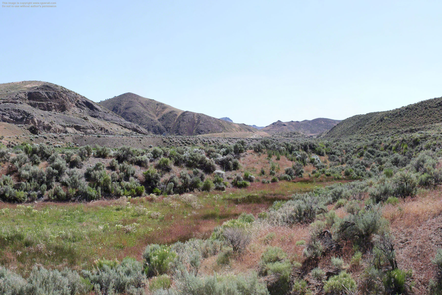

Bottom view, looking over the old Central Pacific grade to the site of the wreck.

Middle view, looking east along the old Central Pacific grade. Lower view, looking west.


Above, UP GE C44-60AC #6922 and GE AC4460CW #7021 haul a coal train west.


Above, UP GE AC44CW #6157 and GE AC44CW #6739 on the rear end.


Above, three views of the coal train from the escarpment above the river valley.


Above, the road swings back to the east just before reaching Barth. These are two views just west of Barth at the foot of Two Hill Canyon. The top view looking east shows a characteristic rhyolite outcrop. The bottom view is looking west.
Silver ore was discovered near Barth in 1881 and a small town soon grew called Safford, including a saloon, lodging house, schoolhouse and post office. A stagecoach ran to nearby Gerald and back three times a week, but the settlement was shortlived. The post office closed in 1883 and, a few years later, the place was deserted. In 1903, American Smelting and Refining opened the West Iron Mine at the mouth of Safford Canyon at what is now known as Barth.


Above, heading east towards Barth. This was the old Central Pacific grade.


Top, two views of what was originally a rail bridge across the Humboldt to service the Barth mine from a spur off the old Central Pacific. The bridge is dated 1902 and is probably another Southern Pacific standard span. Lower, photo, another view of the
1902 span on the left. There are two bridges adjacent to each other on the right. The lines crossed about a mile east of here, so the girder bridge nearest carries the old Central Pacific line, the trestle bridge on the other side carries what was once the Western
Pacific.
From 1903 to 1918, the Barth mine produced just under $2 million in iron ore. It was then abandoned until 1954, when the Nevada Barth Mining Company restarted mining operations.


Above, the two bridges across the Humboldt.
Left, looking northeast. A few Southern Pacific hopper cars
remain. Another spur ran from there round to iron ore deposits in the valley beyond.
Right, UP GE AC44CWCTE #2725 and GE AC44CW #7105 approach hauling a train of BNGZ three-bay grain hoppers
west.
Barth mine was an open cast mining operation, without mine shafts.
The mine appears to have ceased operating some time in 1980s, although there is still quite a bit of mining equipment there.


Above, looking west back over towards Barth from about a half mile further along the unnamed road. The expanse of iron ore tailings that remain here make Barth show as a black smear on satellite map views.
From Barth, the road swings away from the railroad south through Stafford Canyon to curve down through Rocky Canyon in an arc of about seven miles to rejoin the line near Harney. Again, the driving is tough in places and there are no road signs. I recommend using a GPS navigation system if you don’t want to get lost.
Above, UP GE AC44CWCTE #6250 is the helper on the rear.

Above, looking northeast to the iron ore tailings from the spent mine.


Top, looking west from the crest of hills between Rocky Canyon and the Humboldt River. Harney is to the right of this view. Beowawe is at the foot of the hills in the distance.
Lower view, looking northeast towards Harney. The western entrance to Palisade Canyon is on the right. Because of its topography, the canyon was unsuitable for emigrants on the California Trail during the 19th Century. East of the canyon, the trail climbed through Emigrant Gap north of the river for about thirty miles before returning to the river near Cluro at a place called Gravelly Ford. From there, emigrants would continue along the north or south bank of the river to the Humboldt Sink near Lovelock, NV.

Above, two views looking back towards Harney driving west on Pioneer Pass Road.


Above, UP GE AC44CW #7244 and GE C44AC #6448 head west towards Beowawe.


Above, UP GE AC44CWCTE #5745 is on the rear end of this train of hopper cars.


Above, approaching Beowawe heading northwest on Pioneer Pass Road.
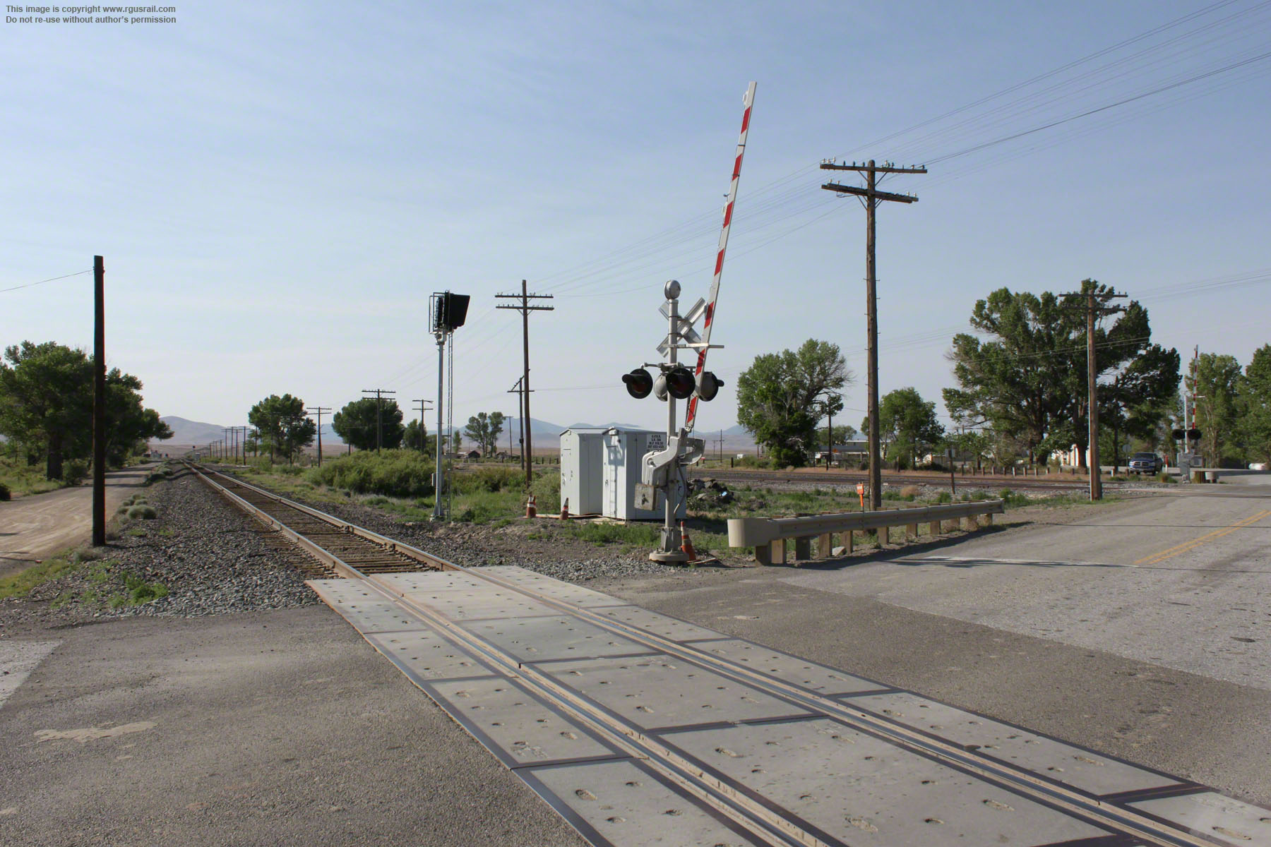
Here, the Humboldt cuts through a low spur on the Red Range. The Paiute Native American Indians had camped at this place for generations and gave the name “Beowawe”, which means “gate”, because of this feature. A small trading post was set up here by European traders in the 1840s to service emigrants on the California Trail as well as the local Paiute population. The town itself was platted after the arrival of the Central Pacific in 1868.


Above, looking east along what was once the Central Pacific grade.
Top, looking north across what was once the Central Pacific line to the old Western Pacific. Lower view, looking northeast along what was once the old Central Pacific. The wooden structure on the left is a loading platform near where the old Southern Pacific depot stood
The town reached its peak around 1881 with a population of sixty people, mostly Chinese immigrants who had been employed to build the Central Pacific. It then had a school, church,
post office, store and library. For much of its life, it also served as a link to the outside world for the Cortez Mines thirty miles south. In 1909 a power plant was built but, by 1916, most of the residents had left.

Above, there is very little at Beowawe today, just a handful of houses.


Above, UP EMD SD70ACe #8731 and GE ES44AC #6751 hauling an intermodal freight.