


The Allegheny Portage Railroad National Historic Site extends from the western end of the township of Hollidaysburg to Summit, PA, and encompasses the remains of part of the first railroad to be built across the Allegheny Mountains. During its construction from 1832 to 1833, this ranked as one of the largest public projects in the world and was considered an engineering marvel of the day. The railroad comprised ten inclines or "planes". The remains of these on the eastern climb have been preserved as part of the National Historic Site, but the five on the western climb have long been built over. At its western end, the line also included the first railroad tunnel built in the US.
Climbing the face of the Allegheny Escarpment to the Allegheny Plateau, which extends west to Pittsburgh, the portage railroad was part of a much larger rail and canal system, the Pennsylvania Main Line of Public Works, built by the Commonwealth of Pennsylvania. It consisted of the eighty-two mile Philadelphia & Columbia Railroad between the namesake centres in Lancaster County, PA, one hundred and seventy miles of canal from Columbia to Hollidaysburg, the thirty-six mile Allegheny Portage Railroad and another one hundred and three miles of canal to Pittsburgh from the railroad's western terminus in Johnstown, PA.
I spent a day hiking the eastern trace and another day driving/hiking the western route, so the sequence here is from Plane ten to Plane one, i.e. from east to west. There are also some photographs from an earlier visit I made in autumn one year.


The eastern terminus of the railroad was located at the small town of Hollidaysburg in Blair County, PA. Here, it interchanged with the western end of the Juniata Division of the Pennsylvania Canal running one hundred and twenty-seven miles from Duncan's Island at the mouth of the Juniata River to Hollidaysburg.
Above, the Pennsylvania Historic and Museum Commission erected a historic marker in 1981 to commemorate the historic railroad. It is located at the corner of South Juniata and Broad Streets in Hollidaysburg, a little north of the location of the original canal terminus and railroad facilities.

Above, a view of the restored terminus building and the remains of Guard Lock #38 at the Hollidaysburg Canal Basin Park. Behind, there is only grassed turf, but there was once a set of wharves, warehouses and an interchange for passengers from the canal to the railroad. Although the Portage Railroad ceased operation in 1854, the canal continued in use until 1872.

The Juniata Division Canal was built in sections from 1827, and opened to 1832.
Eighty-six locks were needed to overcome a change in elevation of 584' over the length of the canal.
The original wheels, rails and ties at the Park were preserved by the Pennsylvania Railroad at the suggestion of J. King McLanahan Snr., and given to the Blair County Historical Society.


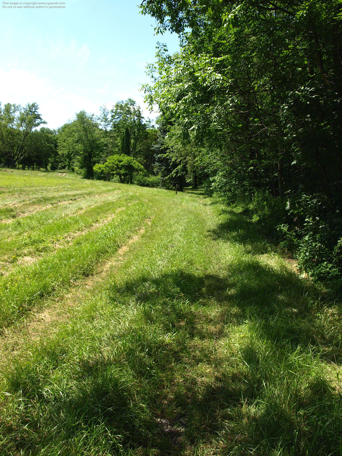
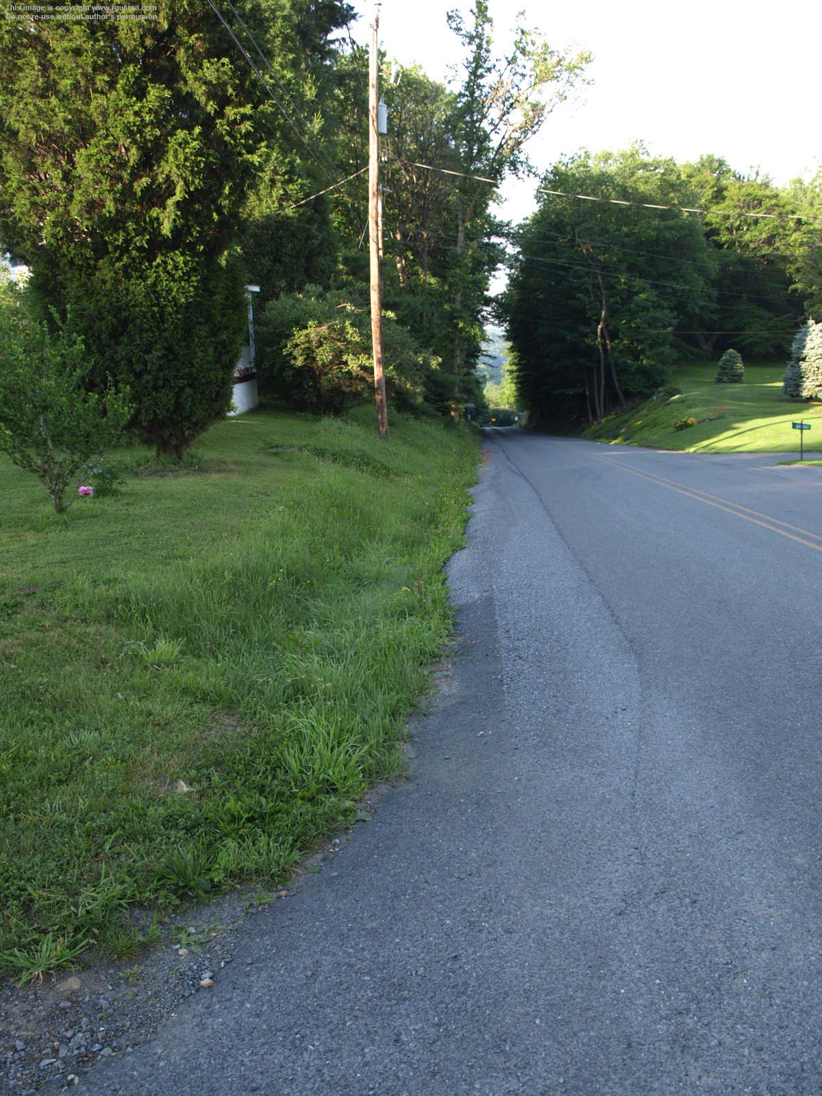
A few miles west of Canal Basin Park, Foot of Ten Road is a present reminder of the railroad's original place in this landscape.
Plane 10 was the first incline encountered travelling west, and the eastern end of Foot of Ten Road is only a few hundred yards from the remains of that plane. It is at the southern end of the Allegheny Portage National Historic Site, which extends roughly 6½ miles north west to Summit.
The area was designated a National Historic Landmark in 1962. In 1987, the American Society of Civil Engineers made it a National Historic Civil Engineering Landmark.
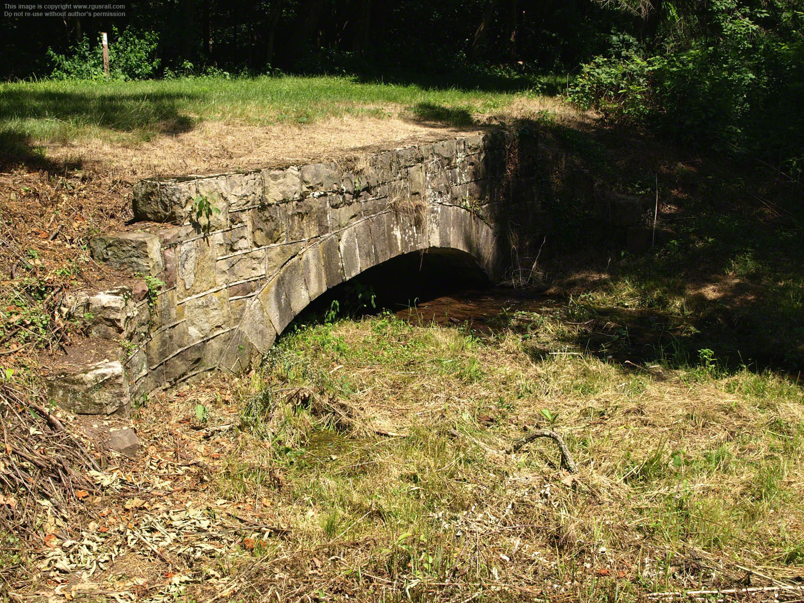
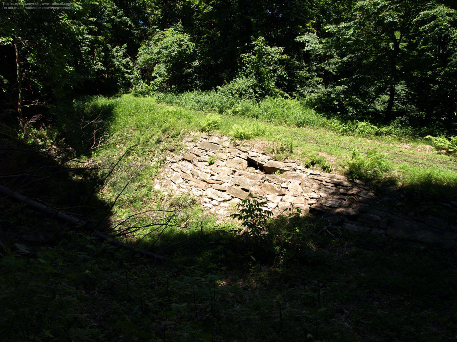
The small, dressed stone culvert 1733 at the foot of Plane 10 was one of the first to be built.
The foot of Plane 10 is 3.7 miles west of Hollidaysburg.

Above, looking up Plane 10 above culvert 1733.
At this point, Plane 10 has already begun its ascent.

Above, looking west halfway up Plane 10.
The ruts suggest a recent visit by National Park Service staff.

Above, approaching the head of Plane 10.
The engine house was in the open area straight ahead.

Above, a panorama of the site of Engine House 10. Although only a few hundred yards from Foot of Ten Road, you have to go a mile or so down Mill Road to Dry Run Road to access a hiking route to this site. The National Parks Service has built parking spaces for a few cars at the trailhead, and there are also maps displayed there. The trail is an easy walk.
In the view above, Plane 10 falls away on the left. The level running to Plane 9 begins on the right. Plane 10 itself is 2,295' long and rises 180.5' on a 7.9% grade.
Stationary steam engines in each of the ten engine houses towed railroad cars and small boats on flatbed cars up the five eastern planes and then lowered them down the five west of Summit. Between the planes, cars were hauled on eleven less steep areas called "levels", initially by teams of horses but, after 1835, by steam locomotives.
The cars were hoisted up each plane by continuous hemp ropes. These cost $3,000 each and had an average life of sixteen months. They were later replaced by steel ropes.

Above, the level between Plane 10 and Plane 9 heads west.
Old Engine House 10 was behind this view.

Above, the old trace winds through the trees.
It follows the original line of the Old Portage Railroad.

After a quarter mile, the level approaches the New Portage Railroad.
The new railroad ran on some of the old grades.

Above, the level joins the New Portage trace.
Efforts to find an alternative to the complicated planes and levels of the Old Portage began within two years of its completion. In 1836, the first survey was carried out to locate a continuous rail route, but it was not until 1851 that the Commonwealth of Pennsylvania began work on what would become the New Portage Railroad.

Above, a view looking west along the New Portage trace just after it joins the Old Portage.
The New Portage trace is gravelled and well maintained. It is suitable for cycling and hiking.

A few miles west, this view is looking east,
The Old Portage splits from the New Portage just beyond the trees.

Above, looking west from this point, the trace crosses culvert 1656.
The stone work of the north face of the culvert is just visible at the edge of the trace in the sunlight on the right.

Nestled in the undergrowth, the south facing stone work of Culvert 1656 is quite unprepossessing.
Culverts were essential to drain the rains and melting snow of Allegheny winters.

Above, looking west above culvert 1656.
This is a few hundred yards from Valley Forge Road.


The north facing stone work reveals 1656 as one of several neatly dressed culverts surviving along the trace. Its face may well have been restored from a previously dilapidated condition.
By 1852 the New Portage Railroad had passed the first three inclines on the western side of the Old Portage, shutting off traffic on those as well as through Staple Bend Tunnel. While the New Portage was still nearing completion in 1854, however, the Pennsylvania Railroad also connected Philadelphia and Pittsburgh by an uninterrupted rail line.
The PRR line ran west of the Old Portage through Horseshoe Curve and what is now the middle bore of the Gallitzin Tunnels. It used a short section of the Old Portage near South Fork and a longer section adjacent to the New Portage through a trackage rights agreement.
Although public opinion had already shifted away from the Commonwealth's huge investment in the Main Line, construction on the New Portage Railroad continued, and its forty-five mile length was also completed in 1854 at a cost of $2,143,355.49.
Below, Valley Forge Road.

Impetus for the Main Line arose from concerns regarding competition for traffic by the Erie Canal, opened in New York State in 1825, the Chesapeake & Ohio Canal completed in 1828 and the Baltimore & Ohio Railroad's seemingly inexorable growth west from Baltimore. If nothing was done, it was feared, Philadelphia would become little more than a backwater!
A short walk from Valley Forge Road, the trace approaches and cuts across the lower end of an open field.

This is actually a delightful spot in summer. When I hiked the trace, I stopped here for lunch.
Culvert 1635 is amongst the trees at the far end of the lower photograph.

Culvert 1635 is quite low and shallow, and its south face is somewhat unprepossessing ...

... but the north face is a study in green.
By 1826, the state had approved construction of the proposed four hundred mile Pennsylvania Main Line of Public Works, and work had already begun on the western end at Pittsburgh, although the first fully loaded canal boat would not travel from Johnstown to Pittsburgh until 1831.
Work had also begun on parts of the eastern section in 1826. It had initially been planned to build a 4½ mile canal tunnel through the Alleghenies, but the impracticality of what would be a mammoth engineering feat was soon realised and attention turned to a railroad or combined railroad and turnpike.


Above, looking west from the foot of Plane 9.

Above, Plane 9 approaches the line of the New Portage route.

Above, looking west half way up Plane 9.

At the head of Plane 9, the trace joins the line of the New Portage route.
I was recently informed by Doug Bosley, a ranger at Allegheny Portage Railroad NHS, that archaeology done a few years ago found a mostly intact engine house foundation just above the New Portage at this location, along with a small section of the plane, more of the level and another culvert. My thanks to Doug for this information.
The foot of Plane 9 is 1.7 miles from the head of Plane 10. It is 2,720' long and rises 189.5' on a 7% grade.

Above, a photo of culvert #1586 kindly provided by Doug.
The culvert is a few hundred yards west of the head of Plane 9. The Old Portage is running along the fill at the top of the photo. The New Portage is on the other side of the fill and about fifteen feet lower down. The culvert was also extended on the other side so that it could pass under the New Portage when that was built in the
1850s.
This side of the culvert was restored in 2012. Many of the stones had slid down and the culvert itself was blocked. The whole side of the fill was originally lined with a slope wall. Much is still left and some has been restored.


About a mile from the head of Plane 9, the trace splits from the New Portage Railroad.
The view above is looking east.

Above, the trace runs down from the New Portage trace.
The New Portage embankment rises up on the left of this photograph.
Above, looking west from this point, the level dips down into the trees.
This part of the trace is accessed from a spur off the New Portage.

Culvert 1532 is a few hundred yards along.
This culvert crosses Blair Gap Run, which forms much of the valley through which the Old Portage climbs west.
Below, two views of the north face of culvert 1532. It is built of a combination of rusticated and dressed stone.


Below, three views of the south face of culvert 1532.


Above, the foot of Plane 8 lies east of an embankment that supported the New Portage Railroad.
Above, looking west from the New Portage Railroad embankment. Completing this embankment was the last work on the New Portage, which couldn't be done while the Old Portage was in use.

Above, Plane 8 climbs away from the New Portage embankment.

Above, a view looking west part of the way up Plane 8.
Culvert 1503 and its retaining wall are about half way up Plane 8. The retaining wall was built to prevent subsidence of the line here, which occurred often during winter. The railroad was closed for most of the winter months and, when the frost had cleared, a considerable amount of work was required to adjust and repair track thrown out of true and repair sections of track where the rail bed had risen and settled.

Above, a view near the head of Plane 8 as the trace approaches the site of what was once Engine House 8.
The foot of Plane 8 is 1.2 miles from the head of Plane 9.
At 9.9%, Plane 8 had the steepest grade of any on the Old Portage, and rose the highest elevation of 308'. At 3,117', Plane 8 was also the longest. As a consequence, it had the longest and heaviest of the original hemp ropes used to haul trains up
the planes: 6,632' in length and weighing 13,221 lbs.
The eastern plane grades averaged 8.86%, the westerns plane grades 8.36%.

Above, a view across the site of what was once Engine House 8 looking east. The stones on the left appear to be remains of an old retaining wall, not the original engine house.
In fact, nothing much remains of the old engine house, except a shallow depression that once housed the cranks and pulleys used to haul trains up Plane 8.

Above, the site of Engine House 8 looking west.
Surveys to lay out the route of the railway line began in 1828, led by Moncure Robinson and assisted by army engineers Colonel Stephen H. Long and Major John Wilson. Moncure was a Virginia engineer who had worked on the Chesterfield Railroad, the first in Virginia, completed in 1831, as well as the James River and Kanawha Canal construction projects.
In April 1831, Sylvester Welch was appointed Chief Engineer, and began calling for construction contracts. It took two thousand men two years to build the railroad, using only hand tools and tons of black powder to excavate and grade across the mountain range. When it was finished, it had cost $1,828,461.38 or $50,790.59 per mile.


Above, looking along the level as it heads west from the site of Engine House 8.


Above, another view looking west further along the level between Planes 8 and 7.

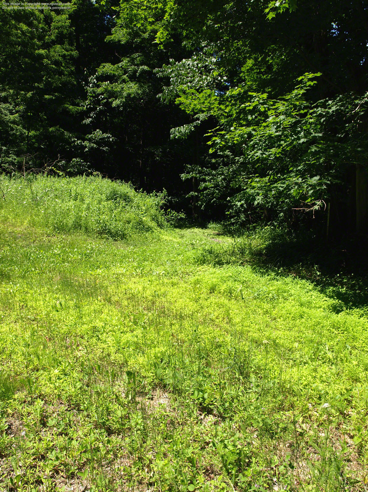
About a quarter mile from the head of Plane 8, the trail becomes progressively more difficult and clogged with forest debris. The National Park Service Trail Guide describes this section as "Moderate Difficulty, Steep Slopes".
Although only about a mile as the crow flies from here to the foot of what used to be Plane 7, the trace twists and turns for two miles. Some time in the future I may return to hike this part of the trace.


Above, a view of Plane 7, which originally ran down what is now the east bound lane of old Highway 22.
This view is, as far as I can ascertain, just to the east of what would have been the head of Plane 7, not far south of Skew Arch Bridge. Engine House 7 once stood a short distance to the left of this position in what is now a heavily overgrown area.
The foot of Plane 7 was 0.6 miles from the head of Plane 8. Plane 7 was 2,665' long and rose 260.5' on a 9.8% grade.
Dense overgrowth makes it hard to locate the short level section of trace between Plane 7 and Plane 6.

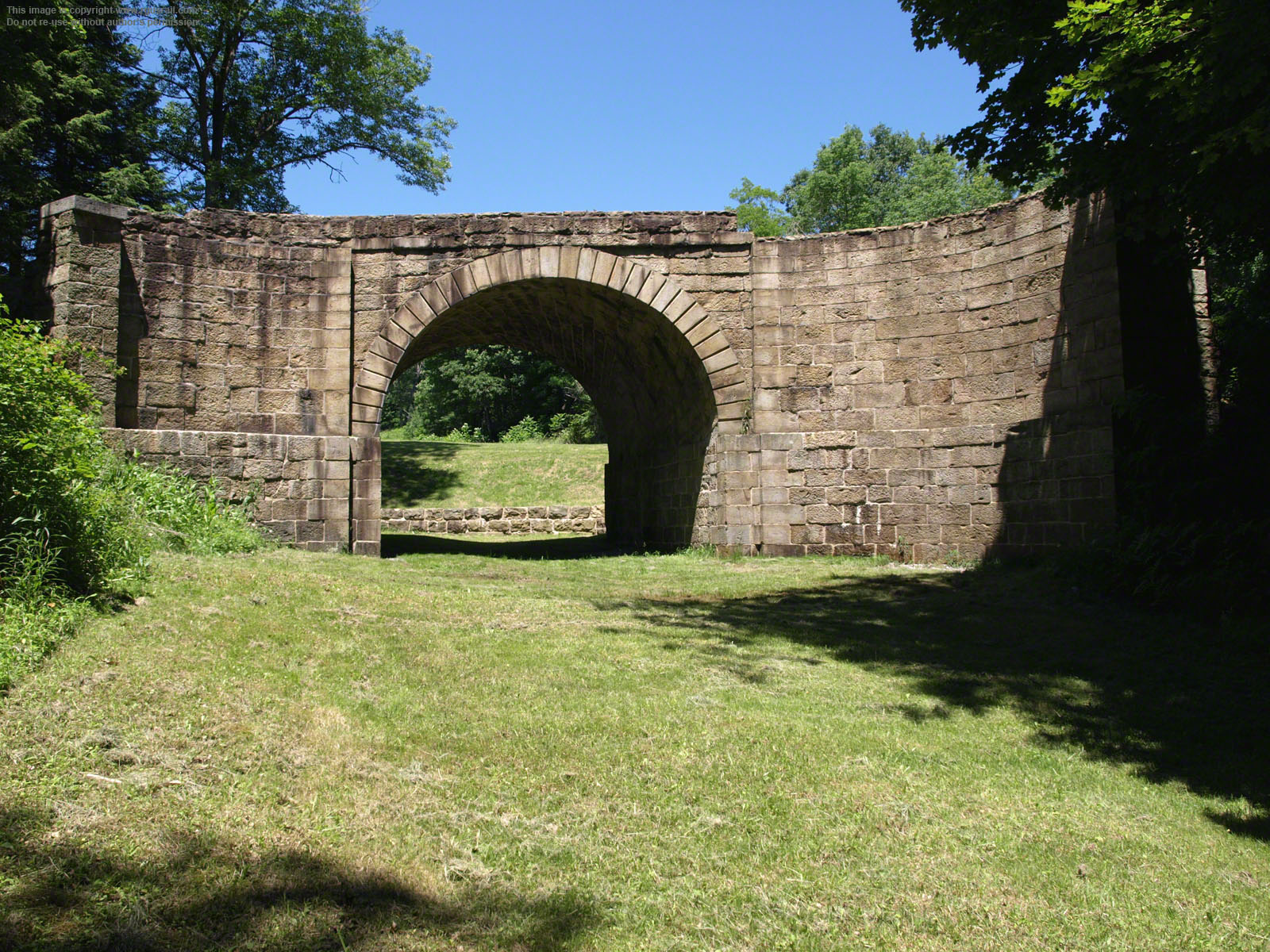


Skew Arch Bridge was built in 1833 by the Fenlon, Darlin and Kininmouth Company. It is 22' 2" high, 60' 5" long on the south elevation and 54' 11" on the north. No plans or elevations have survived.
The bridge started out perpendicular to the railroad but was "skewed" during construction to facilitate the flow of traffic on the steep grade of the turnpike. Constructed from local sandstone without using mortar, it carried the Indiana, Huntingdon & Cambria Turnpike across the railroad at the lower end of Plane 6. The turnpike had been opened in 1820.
Skew Arch Bridge is the only bridge designed to cross the Old Portage. It carried horse-drawn and, later, automobile traffic and remained in use until 1922. In 1979, it was stabilised and repaired, with virtually the entire exterior repointed. Some sealing and remortaring was also done.
The two lanes of Old Highway 22 separate just to the north of the bridge and run each side, west bound traffic to the north, east bound traffic to the south.
There are two traffic parking spots on the island between the two lanes.


Looking up Plane 6 across the highway from Skew Arch Bridge. A few stone sleepers remain.
This photograph was taken in October 2007.


Above, three views taken progressively higher up the plane. This is the only plane that has been restored to roughly how it would have looked during the railroad's operation.
A right of way of 120' was decided on to allow for safe tree felling in the thick forest that covered the area, as well as to secure sufficient land for the envisaged growth of trackage as business improved.


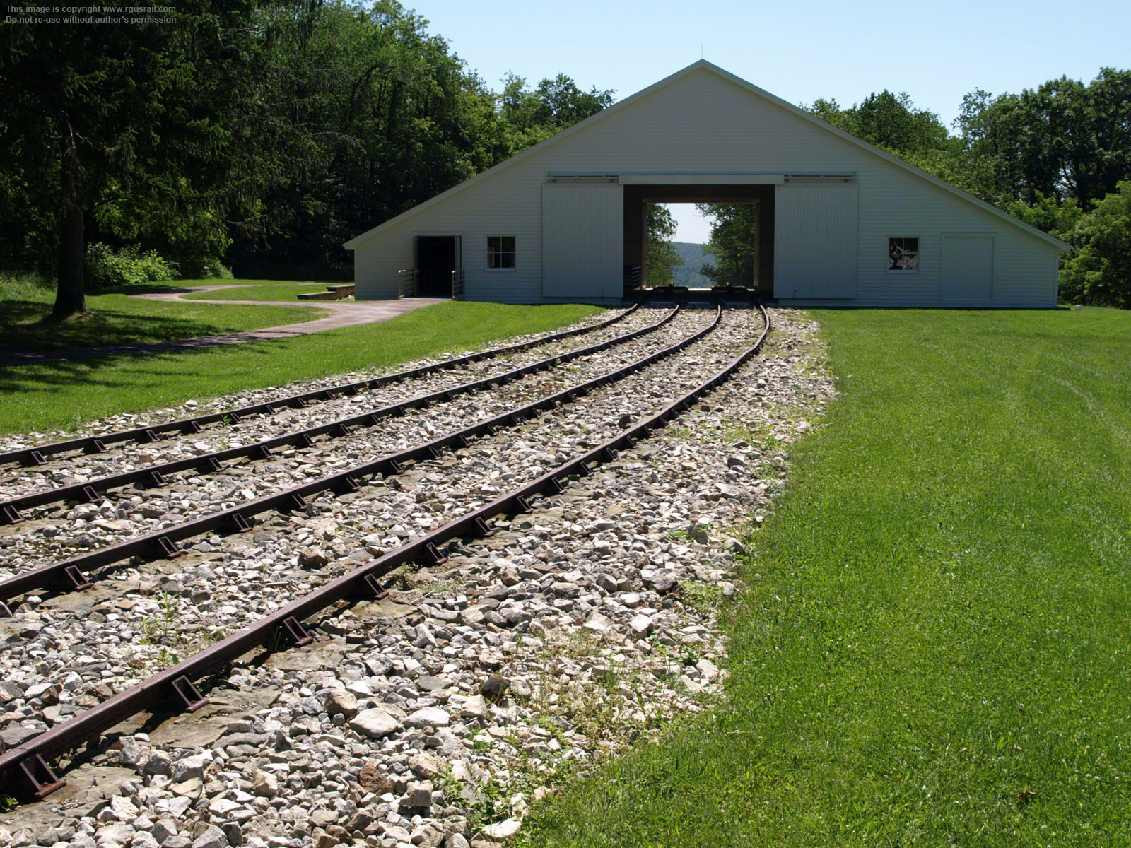
At the top of Plane 6 there is a section of reconstructed railroad track and a replica engine house built by the National Parks Service.
The original Engine House 6 was completed in May 1834. In 1852, the building blew up and a second engine house was built. After the Old Portage was abandoned it was converted to a barn.
The original track was formed of wood rails 6" wide and 8" high called "stringers" covered with a flat iron strip 2¼" wide and ⅝" thick called "straps". The rails were 4' 9" in gauge.
On planes, the wooden rails were notched into wooden cross ties of the same size laid laterally at intervals of 4' in a bed of broken stone ballast.


Above, two views
looking east down the plane from the head of Plane 6. The lower view was taken in October 2007. It shows the evident deterioration of the reconstructed track at that time.
The foot of Plane 6 is 0.15 miles from the head of Plane 7. Plane 6 itself is 2,713' long and rises 266.5' on a 9.7% grade.

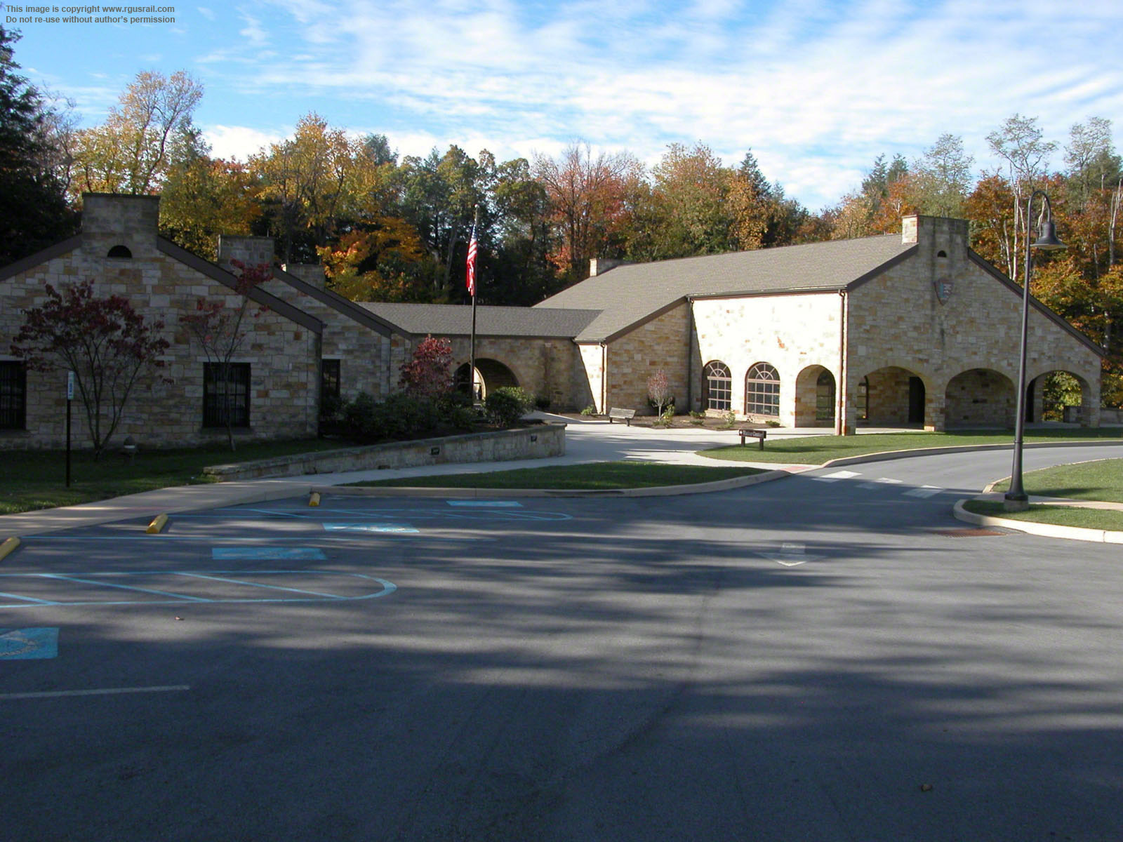
The National Park Service Visitor Centre is a short distance from the head of Plane 6. You can access it from Tunnel Hill Road off Highway 22.

The Visitor Centre has exhibits on the history of the railroad and its operation.
Information signs are also located throughout the site, as well as at Engine House 6 and the Lemon House.

The signs include historic illustrations, maps, elevations and descriptions of artefacts of interest.


When the railroad opened, twenty-five cars were on the line ready for use. Within a month, there were eighty.
The cars were hired out to transport companies and hauled by privately owned horses. Problems soon arose over this system, as maintaining uniform speed over the line was impossible while progress
was controlled by private operators. This led to the decision to use steam
locomotives like the "Lafayette", above, which were owned and operated by the Commonwealth of Philadelphia.
Companies retained the right to attach wagons but the scheduling, speed and operation were managed by the Commonwealth.
By 1837, twelve locomotives were operating on the railroad. Two years later, there were seventeen and, by 1850, the last of the horses had been phased out on Planes 8 and 9. The locomotives worked predominantly on the longer level sections of the railway. When hauling mail or passenger trains, they were permitted to travel at 15 mph. Freight trains were limited to 10 mph.

The "Lafayette" on display at the Visitor Centre is a replica. The original was built by William Norris in Philadelphia, PA, in 1841 and worked out of Hollidaysburg. Norris built nine locomotives for the railroad.
The replica was built by Baltimore & Ohio engineer Joseph York for display at the 1893 Columbian Exposition in Chicago, IL, and was also displayed at the 1904 Louisiana Purchase Exposition in St Louis, MO. It weighs 29,630 lbs and has a grate area of 9.48 sq ft. The two drivers are 48" and the cylinders 20" x 12½"
When the Old Portage ceased operations, the locomotives on the line were dispersed throughout the Pennsylvania Railroad system. Over time, as more powerful locomotives were developed, they were rendered obsolete and scrapped. No surviving locomotives from the Old Portage have been identified.


Engine House 6 is part of the National Parks Service site. It is a reconstruction of the original building and internal workings. The old building was demolished c.1900, although some stone foundations survive.
The top view is the east end of the building. The straps have yet to be fixed to newly laid wooden stringers. The bottom view is the west end, showing the T-shaped "edge rails" used on levels. These were secured using U-shaped cast iron "chairs" held in place by wedges. The chairs were fastened by two iron spikes driven into oak plugs set in the sleepers.


Above, two views of the east facing door and the reconstructed workings. Just outside this door, "hitchers" would connect and disconnect cars as they made their way up or down the line.
Hemp ropes have been installed in the replica engine house. However, in 1843, Engineer John A. Roebling suggested replacing the dangerous and unreliable hemp with safer wire rope. These were first tested on Plane 3 in 1843, then on Plane 10 the following year. Proving successful, they progressively replaced
hemp ropes until all ropes were wire by 1850. The wire ropes also allowed introduction of a counter balance system where ascending cargo could be tied to descending cargo, which proved safer and more economical.
Because of the danger of slipping on the steep inclines, safety cars known as "bucks" were
attached at the lower end of each train. If a rope
broke, a runaway train would ride onto these and the buck's sled-like runners would act as brakes. In reality, some passengers elected to walk beside the cars when on a plane because of their fear of a runaway; and the dangers of travelling on the
railroad were very real, for workers as well as passengers. In 1850-51, for example, there were sixteen recorded deaths by accident, as well as many injuries.

Above is the 9' 6" diameter horizontal wheel that crossed the main tow rope from one track to the other. A hanging weight that was let into a vertical shaft exerted pressure on the wheel to take up slack in the rope.
A hydraulic water brake was fixed to the wheel that helped control the descent of trains when there was no ascending train to counterbalance it. The maximum weight per car was 7,000 lbs, although this was seldom reached except by loads of coal or iron.
Trucks for section boats were introduced in 1843. They were intended to stimulate small traders, but only made up a small proportion of the traffic.
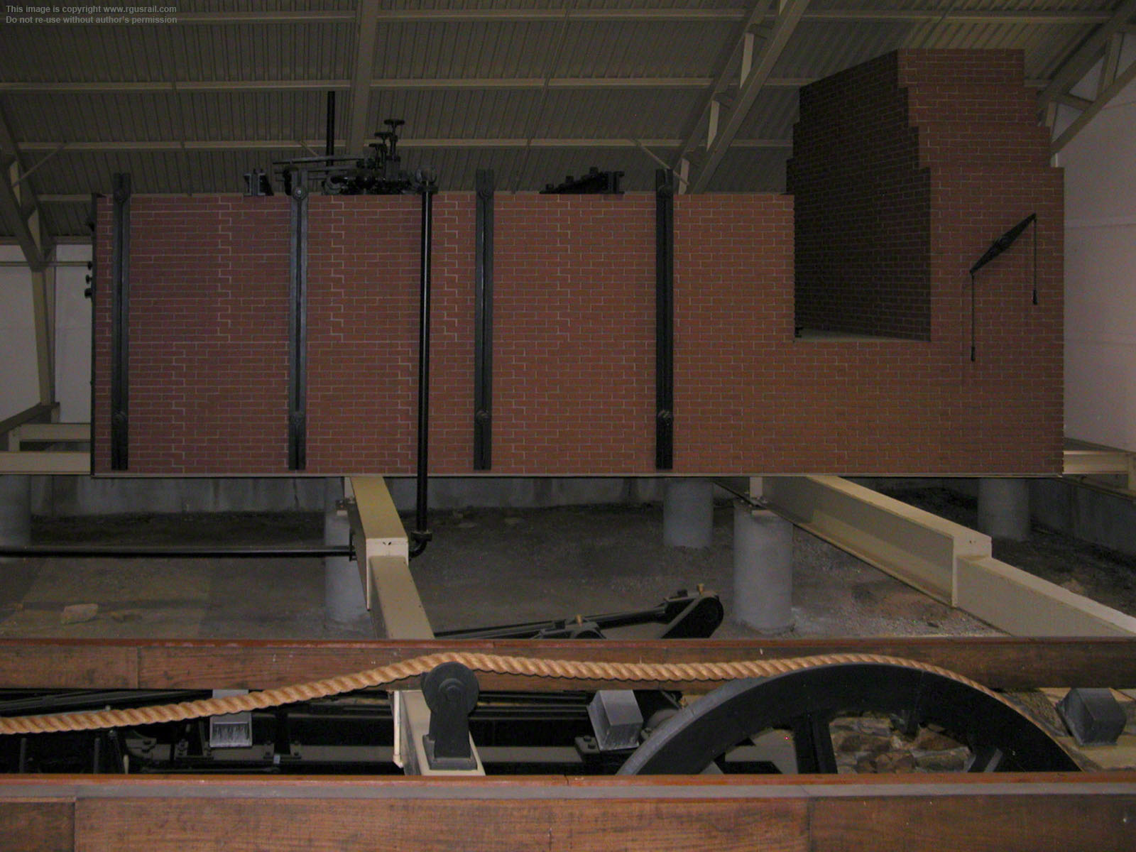
There were eight boilers in each engine house, four on each side. Originally only six had been built, but the heavy loads carried by the railroad necessitated the addition of a fourth boiler on each side. Only one set of boilers was connected at a time, the second being kept in reserve. Above, a replica of the three original boilers on the southern side of Engine House 6.
The boilers did not have flues and were basically iron tubes under which coal or wood was burned to generate steam. They were either 30 hp or 35 hp, and the diameter of the rope varied accordingly, 6¼" for 30 hp engines, 7" for 35 hp. In 1836, all the ropes were increased to 8", except Plane 9, which was increased to only 7½".
Firemen kept the boilers at c.70 psi, feeding the furnaces c.2.4 tons of coal in each twelve hour shift, for which they earned c.$10.50 per day. The season was roughly early March through 1st December, but would continue into December if canals did not freeze. It operated 12 hrs a day, 7 days a week in season but some night operations were allowed if, for example, perishable goods had to be shipped.

Above, a view of the reconstructed workings at the west end of Engine House 6. The far wheel in this view is the crank, which is connected to the second cylinder of the two cylinder steam engine. The connecting rod is just visible between the second and third set of stringers. The cogged wheels in the middle of this view regulated the motion of the ropes.
When a descending train was heavier than the one ascending, the engine would be disengaged. The weight of the train would then be taken up and its progress regulated by the water brake.
Each of the engine houses along the route were operated by crews of four or more. There was an engineer, who maintained the engine and oversaw general operations, an assistant engineer, a fireman and the hitcher. Later, a "train captain" was added to the crew to ride with each train, as well as a brakeman. A principal rigger was in charge of all the ropes and worked with several assistants. A varying number of labourers were also employed for a range of duties such as tending horses, carrying coal and cleaning out the boilers.


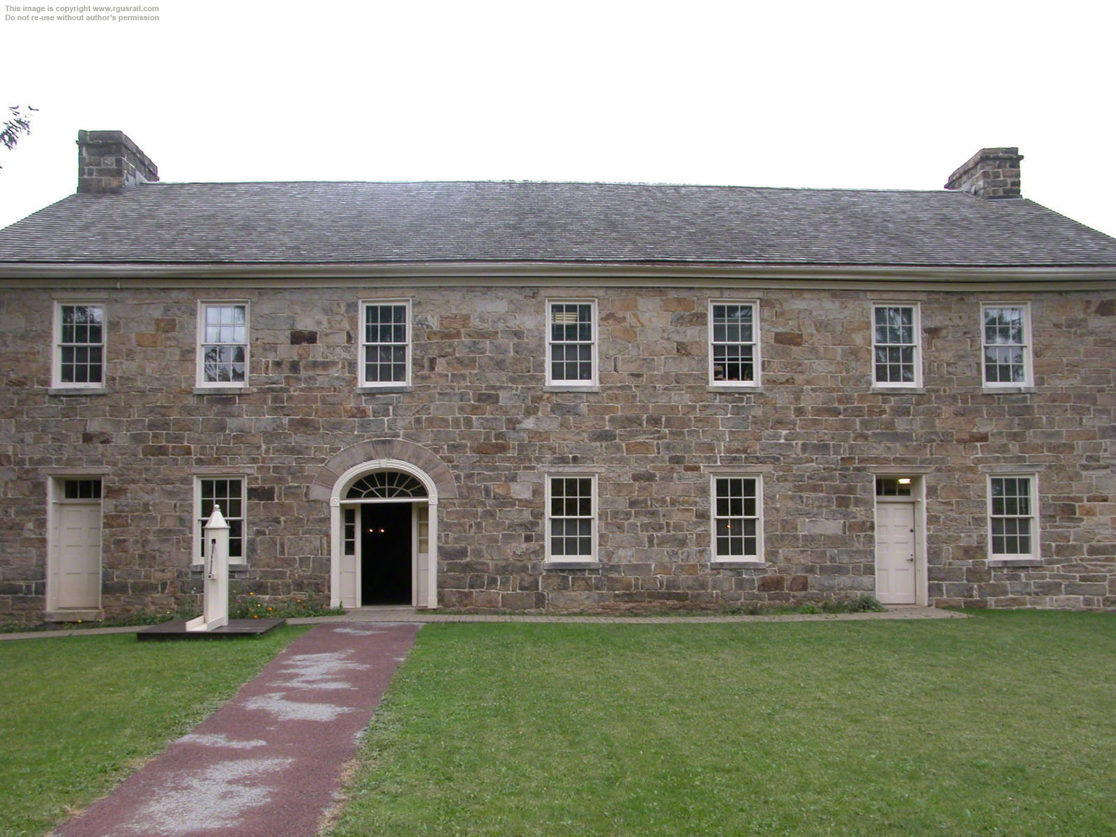
Samuel Lemon and his wife, Jean, had operated a tavern at the nearby turnpike since 1826. In preparation for the projected influx of travellers, in 1832, they built this impressive stone tavern, which became known as "The Lemon House", just a few yards from Engine House 6.
Samuel Lemon also owned a quarry that was probably the source of the sleepers used by the railroad, and he supplied water to Engine House 6, provided horses for hauling cars and sold large quantities of coal to the railroad from a seam discovered on his property.
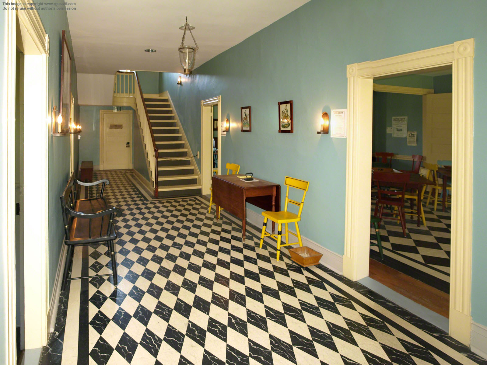
To the left is a view of the hall, just inside the front door.
The NPS has beautifully restored the interior of the house so that it resembles how it would probably have looked when used by travellers stopping roughly half way on their trip over the Alleghenies.
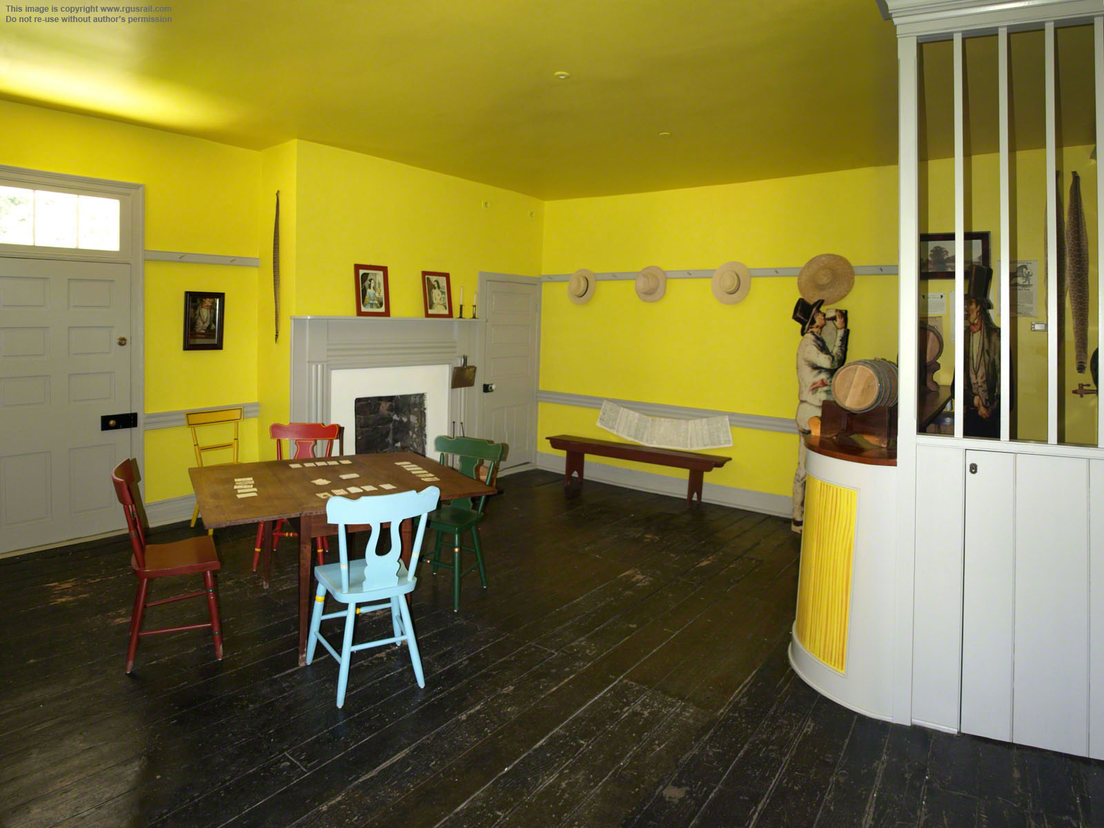

Above, two views inside the bar at the front left of the building on the ground floor. The Lemons lived upstairs, where there were also guest rooms. No record of the prices charged at the Lemon House has been found but, based on the nearby Summit Mansion Hotel's prices it is likely that overnight accommodation cost a quarter, and the same price was charged to stable and feed a team of four horses. In the bar, whiskey was likely to have cost 12½c a shot, a bottle 31¼c, and playing cards 25c per deck.
Passenger trains departed from either end of the railroad at 6.00 or 7.00 in the morning and arrived at their respective destinations at 1.00 or 2.00 in the afternoon. Operators charged $1.25 each way over the railroad, and the fare between Philadelphia and Pittsburgh, PA, was $6. In the first full year of operation, 25,000 passengers travelled across the railroad, 15,437 west and 9,563 east.


Above, two views of the lounge at the rear of the east end of the building.
Although thousands travelled along this route, most immigrants went west on the
Erie Canal and then by rail or steamers across the Great Lakes. Hopes that the railroad would compete with the Erie Canal were therefore never realised. The inconvenience of trans-shipping from
railroad to canal to railroad to canal, the
cost of canal offices at five places on the route, and the problems of carrying loaded boats on railway cars all discouraged through traffic.


Above, two views of the dining area on the west side of the building. Meals were served here and probably cost a quarter each (breakfast, lunch or dinner).
Business declined through the 1840s, along with the condition of the railroad. In 1847, the Lemons moved to Hollidaysburg, although they continued to summer at the tavern. Business virtually ceased after the Old Portage closed in 1854, but the property remained in the family until 1907. It then went through a variety of owners as a hotel, farm house and rental property, until bought by the National Parks Service in 1966.


Above, looking west from the Lemon House along the start of the level between Plane 6 and Plane 5. At this point, the short section of reconstructed road bed through Engine House 6 ends.
The half mile trail from here to Portage Street is part of the National Historic Site, and is a relatively easy and pleasant walk.

Above, looking east towards Engine House 6 and the Lemon House.
This is pretty much how it might have appeared to travellers arriving from the west in the heyday of operations.

Original stone sleepers along the trail. These were cut roughly
2' x 1' 9" square and 1' deep, and set in a bed of ballast.

In certain locations, the sleepers appear to have been removed and set beside the trail.
Repairs were constantly needed. There were land slides, slope walls gave way, embankments settled and rotten wood structures had to be replaced.

Above, in this view halfway along the level looking west, the tranquillity of a summer afternoon belies the difficulties faced by
those who built the railway line.
Working conditions could be tough clearing a 120' swathe through the virgin forest. Solomon Roberts, who supervised work on the western slope, reported that summer gnats were so troublesome his men worked in the smoke of burning leaves and greased their faces to discourage their attention. In winter, as his party were finding a line over the summit, the wind blew so ferociously it tore the bark from dead trees.

Above, the level approaches the dual US 22 over bridges.

Above, the original location of Summit, the highest point on the railroad, 1,338' above Hollidaysburg.
The railroad dropped 1,158' in the twenty-six miles from Summit to the railroad's western terminus in Johnstown.

Below, a few hundred yards from the bridges, a wooden gate signals the boundary of the National Historic Site.

From this point, the remains of the original Old Portage Railroad route can be followed on and off by car and hiking trail about as far as the foot of Plane 1, roughly four miles from Johnstown.
The Old Portage began service on 18th March 1834 but, after less than twenty years, it was progressively abandoned as the New Portage came into use. It ceased operations entirely on 1st July 1855.

Just past the gate, the old railroad route becomes Portage Street.

A few yards further, it crosses Admiral Peary Highway and becomes Level Road.
The old Summit Mansion Hotel stood just to the left at the intersection. The hotel survived until 1950, when it was destroyed by fire.


Above, Level Road takes a sudden dive a few hundred yards from Admiral Peary Highway at the head of what was once Plane 5. The view above is looking west down Plane 5.
The distance from the head of Plane 6 to the head of Plane 5 was 1.6 miles. Plane 5 was 2,628' long and fell 202' at a 7.7% grade.


Above, looking west along Level Road from the foot of what used to be Plane 5.
Much of the old railroad route from here to the township of Portage has been built over, with houses and small businesses along the road side. The view above is typical.
One cent per mile was charged to operators for each freight car running empty along the railroad. When loaded, an additional charge of twice the amount of the toll charged per mile on the canal was levied. In the first full year of operation, 52,719 tons of freight were carried, 29,740 tons west, 15,439 tons west and 7,540 locally.


Above, another sudden dip in Level Road as it approaches the
township of Lilly signals the head of what was once Plane 4.
It was 2.56 miles from the foot of Plane 5 to the head of Plane 4. After Plane 5, Plane 4 was the second longest on the western side. 2,195' long, it fell 188' at an 8.5% grade.


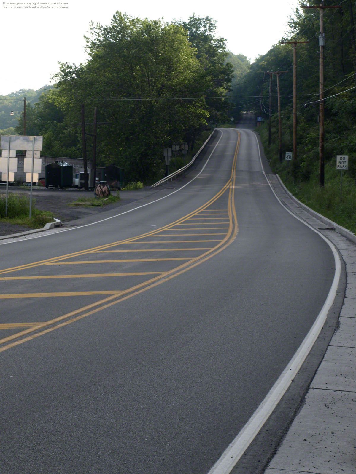
About two-thirds down Plane 4, Level Road ends at North Street. A sharp right onto North Street, a left onto Willow Street and another left onto Cleveland Street takes you to the remains of the foot of Plane 4 on Jones Street.
The two views above are looking east from the old foot of the plane just off Jones Street.


Above, a view looking west from the original foot of Plane 4. Jones Street intersects Cleveland Street to the right at the stop sign.
The road curving to the right in the distance, along what is appropriately named Portage Street, is a continuation of the Old Portage line. Portage Street forms part of Highway 53 and meanders about ten
miles from here to Summerhill.
The three telegraph
poles in the upper
middle of this view are just in front of the bridge across Burgoon Run. There is no sign of the old bridge across Burgoon Run from Portage Street.

Above, on the north side of the bridge, it is evident that the concrete base of the
highway has been laid directly on top of the old stone structure. A modern retaining wall has also been constructed against the west abutment.

Above, on the south side, except for the rather ugly concrete barrier, a little minor reinforcement and a some quite cack-handed repointing, the original bridge appears to be perfectly intact.
This is actually a rare survivor. Most of the bridges along the route west were replaced when the road was built.


Above, just east of Cassandra, another dip in Portage Street is what was once Plane 3. This is looking west half way up the old plane.

Above, looking east from the foot of Plane 3.
At 1,480', this was the shortest plane. It fell 130.5' at an 8.8% grade. It was 1 mile from the foot of Plane 4 to the head of Plane 3.


The Old Portage route diverges from Portage Street onto Plane Road near Jamestown.
About half a mile further, approaching the township of Portage, Plane Road dips into what was once Plane 2. The view above is looking west from the head of Plane 2.
It was 1.4 miles from the foot of Plane 3 to the head of Plane 2. Plane 2 was 1,769' long and fell 132' at a 7.5% grade, the shallowest on the western part of the Old Portage.
The Old Portage Railroad clung to the southern side of the Little Conemaugh River valley for most of its course from Summit to Johnstown.

Plane Road rejoins Portage Street at the foot of old Plane 2.
The intersection can just be made out in the upper left of the photograph above.
Above, looking east from the foot of old Plane 2 on Portage Street.
The intersection with Plane Road is in the upper right of this view.


Close to the foot of old Plane 2 at the intersection of Portage Street and Munster Road there is an historic marker commemorating the railroad and recording that nearby Portage was its headquarters.
Portage was established in the 1830s specifically to service the railroad. A period of decline followed closure of the Old Portage, but the township found new life in the 1870s as a centre of coal mining operations.

Above, a view looking west along Portage Street from the nearby intersection with Main Street.
From here to Mineral Point, the Old Portage route is less accessible as parts of it were taken over by the New Portage in the 1850s and the Pennsylvania Railroad subsequently incorporated some of these into its system. In fact, some of the current Norfolk Southern trackage, originally surveyed by the Pennsy, runs over what was once the Old Portage.
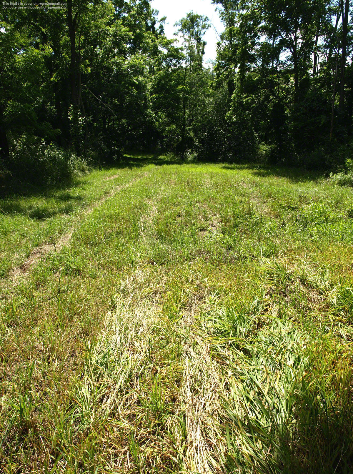
At thirteen miles, the level between Planes 2 and 1 is the longest on the line. It was known as the "Long Level" by railroad employees.


The township of Mineral Point is about a ten and a half mile drive from Portage. Then, from Mineral Point Road, it is a short drive down Beech Hill Road to the entry point to the second section of the Allegheny Portage National Historic Site. This runs about two miles in a roughly 500' wide arc from here to the southwest
There are parking spaces and toilet facilities at the trail head. There are also a number of signs explaining the background to the railroad's construction and giving information on Staple Bend Tunnel at the far end of the trail.

The view above is
looking east towards Beech Hill Road and the facilities at the NHS trail head.

Above, a view looking west along the old trace from the trail head.
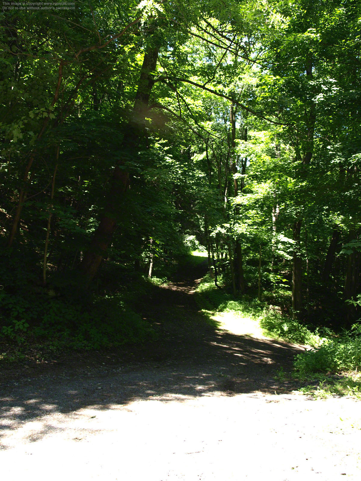
The trail itself is gravelled the whole way and is a relatively easy walk. Cyclists can also use the trail.
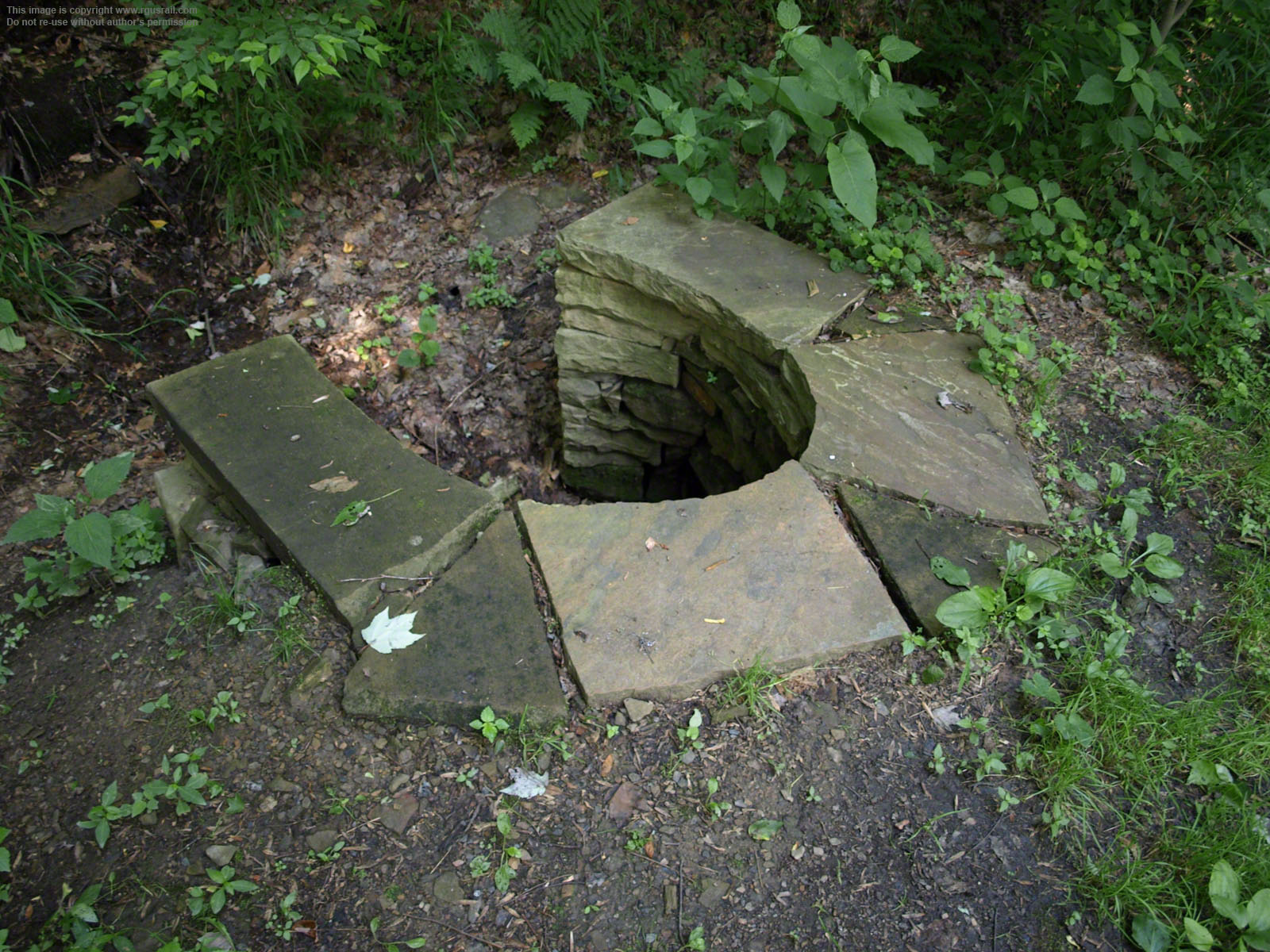

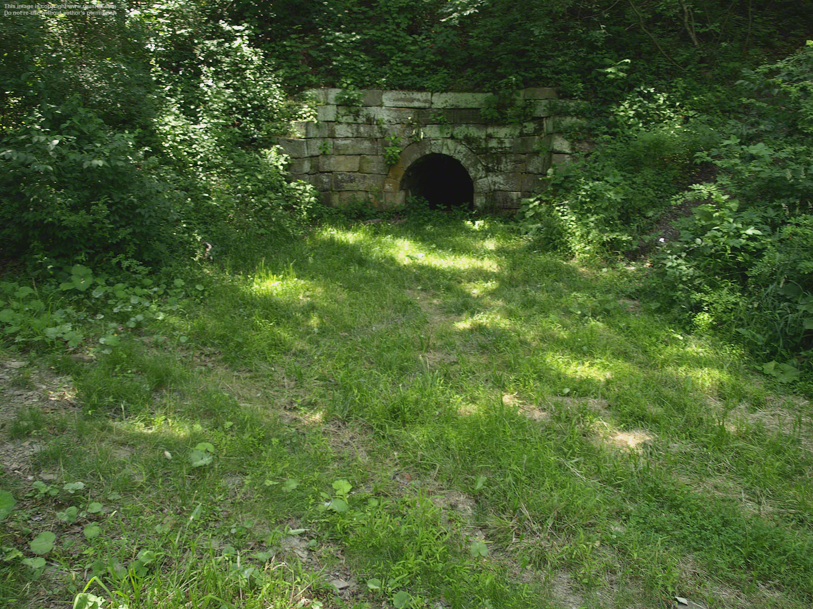
Above, two views of a small, unnamed culvert about one quarter of the way along the trail to Staple Bend Tunnel.
In total, seventy-three culverts and eighty-five drains were built along the route of the Old Portage. Most were built from local sandstone.
The great majority of these structures have unfortunately disappeared since abandonment of the railroad, but those that survive in the two parts of the National Historic Site are looked after by the National Parks Service.

Above, the remains of another unnamed culvert.

There are several signs along the trail. The one above describes the general operation of the Old Portage.
Ex-Pennsylvania Railroad tracks, now part of Norfolk Southern, run close to the trail for much of the way, so you will hear the growl of freight trains. The fact that this line, which follows the route surveyed by the Pennsy in the early 1850s, still runs so close to the Old Portage is testament to the skill of the original surveyors.


The original sleepers survive in many places along the trail. In some, they are three rows wide. Sidings were probably situated at these locations to allow trains to pass on what was, over most of its length, a single track railroad.
As a result of demands to reduce the Commonwealth's debt (it had invested $14,361,325.50 on the Main Line of Public Works), both the Old and New Portages were put up for sale in 1854 for $20,000,000. In May 1855, the asking price was dropped to $10,000,000, but there were still no bidders. Two years later, on 25th June 1857, the New Portage was put up for auction on its own. The Pennsylvania Railroad was the only bidder and paid $7,500,000. It took possession on 1st August 1857, but the line only operated for three months under the Pennsy. It was more expensive to operate and less convenient than the line they had constructed through Gallitzin.


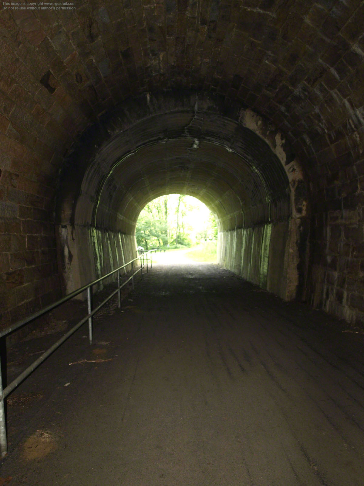
About two miles from the trail head is the east portal of Staple Bend Tunnel, the first railroad tunnel built in the US. It is 20' wide, 19' high and 901' long. It was built by J. and E. Appleton at a cost of $37,798.84.25.
The east portal has been partly restored, but may originally have been finished like the west. In 1994, the tunnel was declared a National Historic Landmark.

Construction of the tunnel was supervised by Solomon W. Roberts, who also helped design and anchor the planes, managed rail importation from England and, in 1835, was put in charge of operation of the entire portage.
The tunnel was fitted with dressed stone 150' at each end where the rock was softer. The east portal is in the left two views below, and the west portal is on the right.
Crews, mostly Irish and Welsh immigrants, worked long hours to build the tunnel, drilling 36" holes, each of which was blasted with black powder. Working from either end toward the centre, they could cut away only 18" a day.
For six years, they chipped and blasted, finally breaking through on 20th December 1832, although six months of more hard work was required before the tunnel was completed.


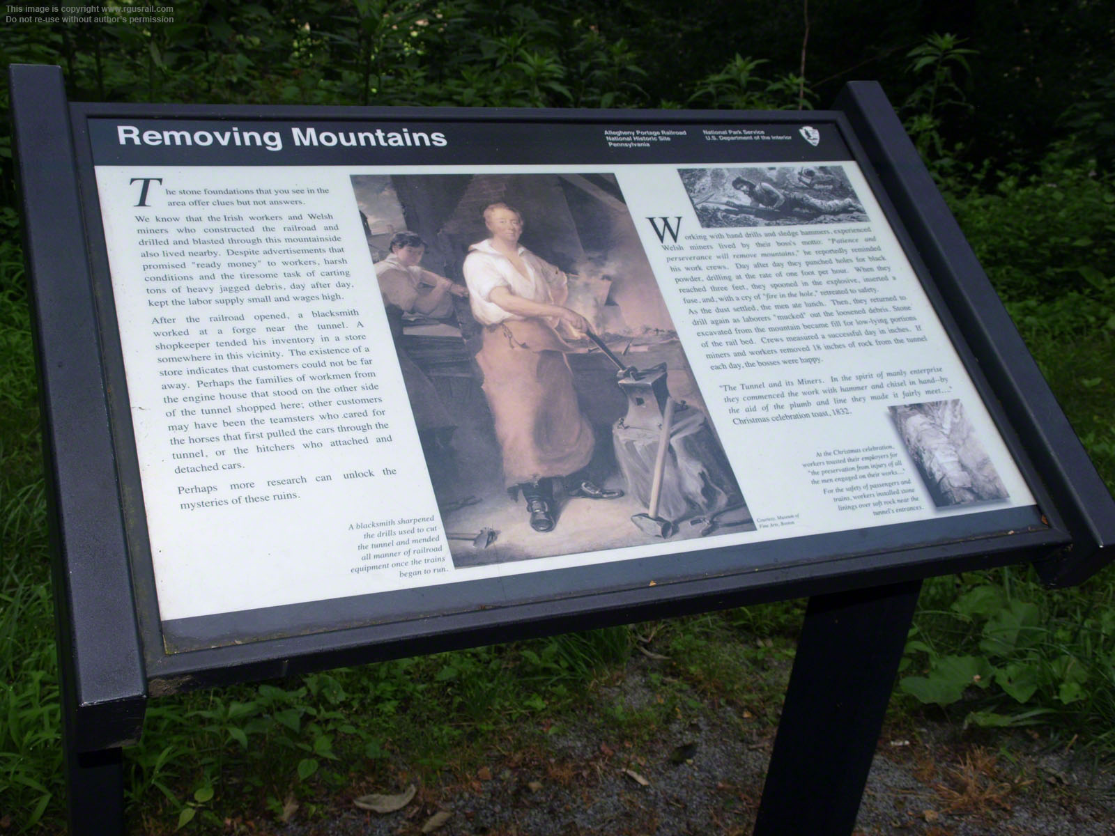
There are information signs at both ends of the tunnel.
The one above at the east portal describes activity in the area during the railroad's years of operation.

Above, one of the signs at the west portal describes the final four mile leg of the journey west to Johnstown.
Before the Old Portage arrived, Johnstown was a small village. The influx of cargo and passengers fed the local economy, which survived closure of the old line as the newly rerouted line still ran through the town.

Above, the west portal of Staple Tunnel with its original imposing Roman Revival façade.

Engine House 1 would have stood at the spot from which the lower photograph above was taken.
The men who built Staple Bend Tunnel understood the magnitude of their achievement in constructing the first railroad tunnel in the US, but it did not remain unique for long. Within six months, the Wadesville Tunnel was completed by the Danville & Pottsville Railroad in Wadesville, PA. In the following years, construction of tunnels grew apace as the network of railroad systems spread across the nation.


Above, a view west across what was the site of Engine House 1 to the head of Plane 1. This was the first or last plane travellers would encounter depending on their direction of travel on the Allegheny Portage Railroad.
It was thirteen miles from the foot of Plane 2 to the head of Plane 1. The plane itself was the second shortest at 1,608' long but, at a 9.3% grade, it was the steepest on the western flank. It fell 150' from head to foot.
Despite the grandeur of its conception, and high hopes for its future, the railroad was not a great success financially: it made a profit in only eight of its twenty years of operation and, from 1834-1857, recorded a net loss of $1,227,773.

Above, a view looking east to Staple Bend Tunnel from just below the head of Plane 1.

Above, about halfway down the plane looking east.

Looking west at the foot of the plane, 4.1 miles from the Old Portage terminus at Johnstown.
The trail currently ends at a small bridge near the foot of the plane, but this part of the old route is part of a larger system known as the "Path of the Flood Trail", which follows the route of the 1889 Johnstown Flood from South Fork to Johnstown along the Little Conemaugh River. The "Path of the Flood Trail" is itself part of the Pittsburgh to Harrisburg Mainline Canal Greenway, a hiking trail that will one day connect the east and west sides of the Alleghenies.
Here, the Norfolk Southern tracks just clip the bottom of the trail. A freight car can be seen in the view above.
Maps
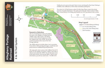
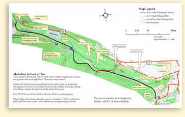
The NPS has published a map of the National Historic Site with hiking trails:
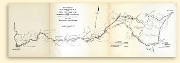
There is also a map of the entire Old Portage Railroad and newer lines constructed by the Pennsy from an 1948 PRR Board of Directors report published on Wikipedia:
http://en.wikipedia.org/wiki/File:1948_Allegheny _Portage_Railroad.jpg
Related Links:
Locations along the Allegheny Portage Railroad
NPS Allegheny Portage Railroad Website
The Allegheny Portage at Funicular Web Magazine
National Park Planner: Allegheny Portage Railroad NHS
Send a comment or query, or request permission to re-use an image.
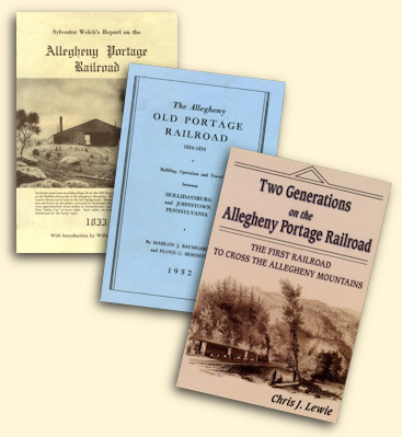
The three main publications on the railroad are Sylvester Welch's 1833 Report on the Allegheny Portage Railroad, reprinted by Thomas Publications of Gettysburg, PA, in 1975; Mahlon J. Baumgardner and Floyd G. Hoenstine's The Allegheny Old Portage Railroad 1834-1854 published by the Pennsylvania Society of Sons of the Revolution in 1952; and Chris J. Lewie's Two Generations on the Allegheny Portage Railroad by Burd Street Press of Shippensburg, PA, 2010 (click on the cover to search for any of these books on Bookfinder.com).